- Introduction
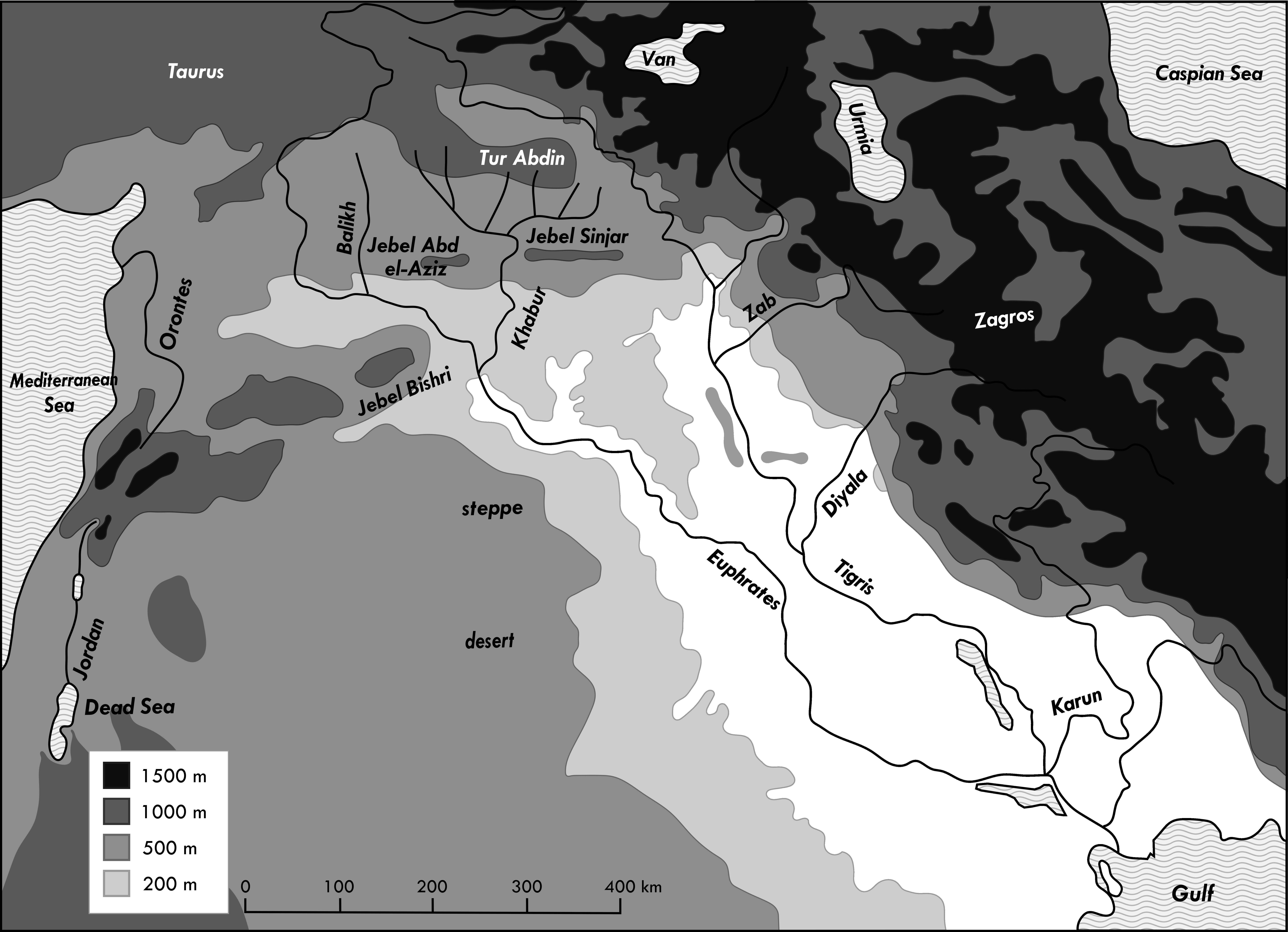
- Map 1: Oro- and hydrography
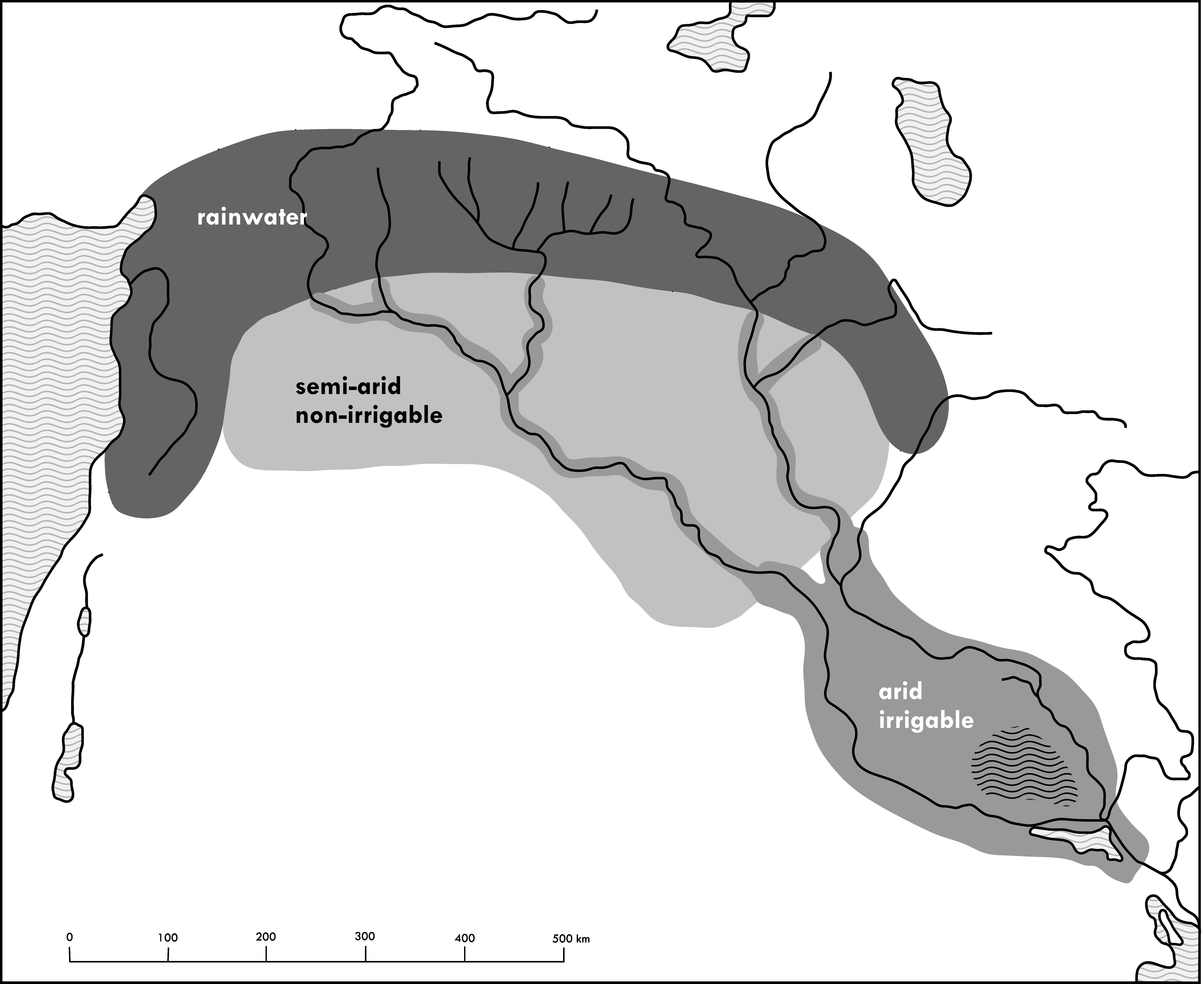
- Map 2: The three climatic zones
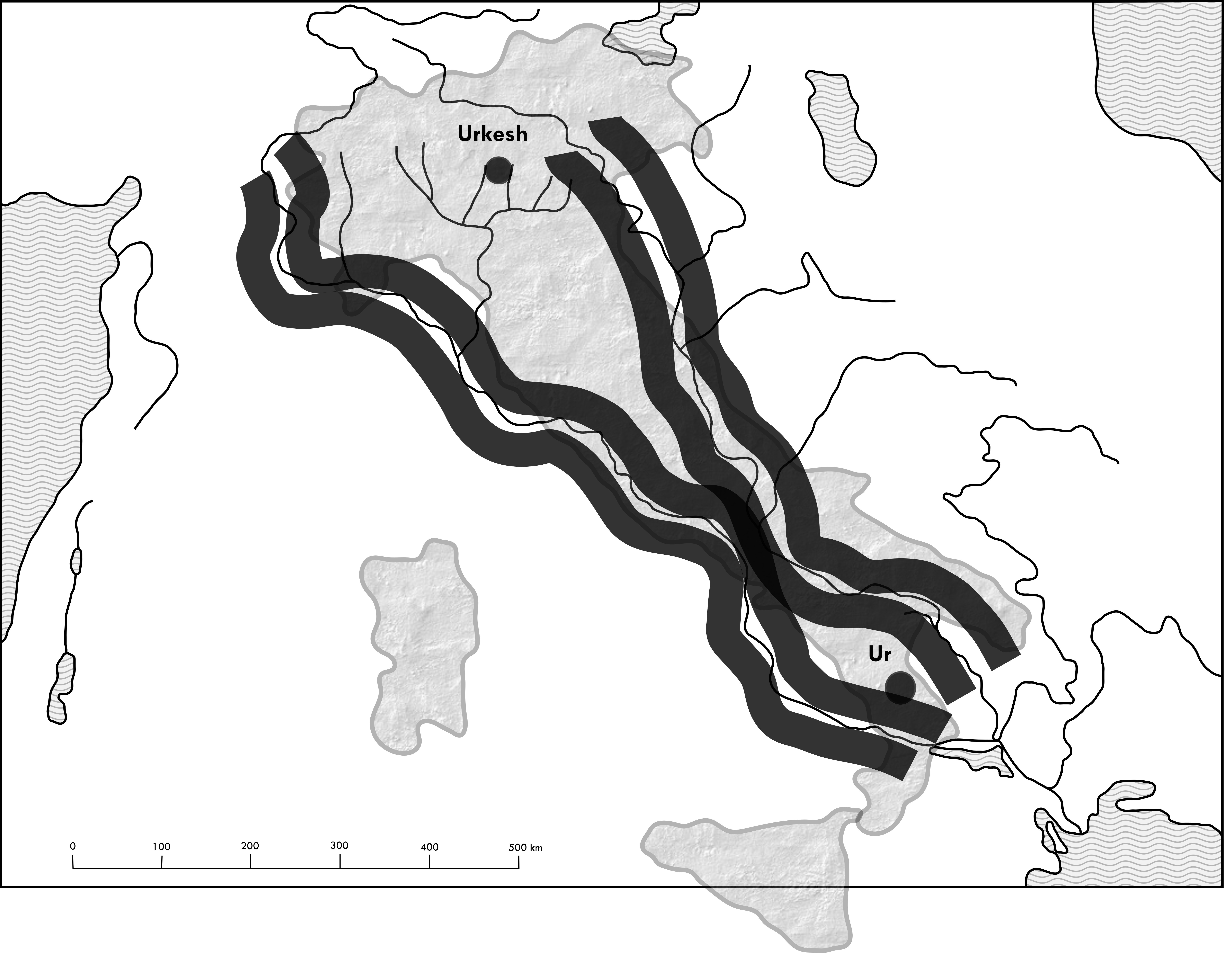
- Map 3: The “Land of the Four River Banks”
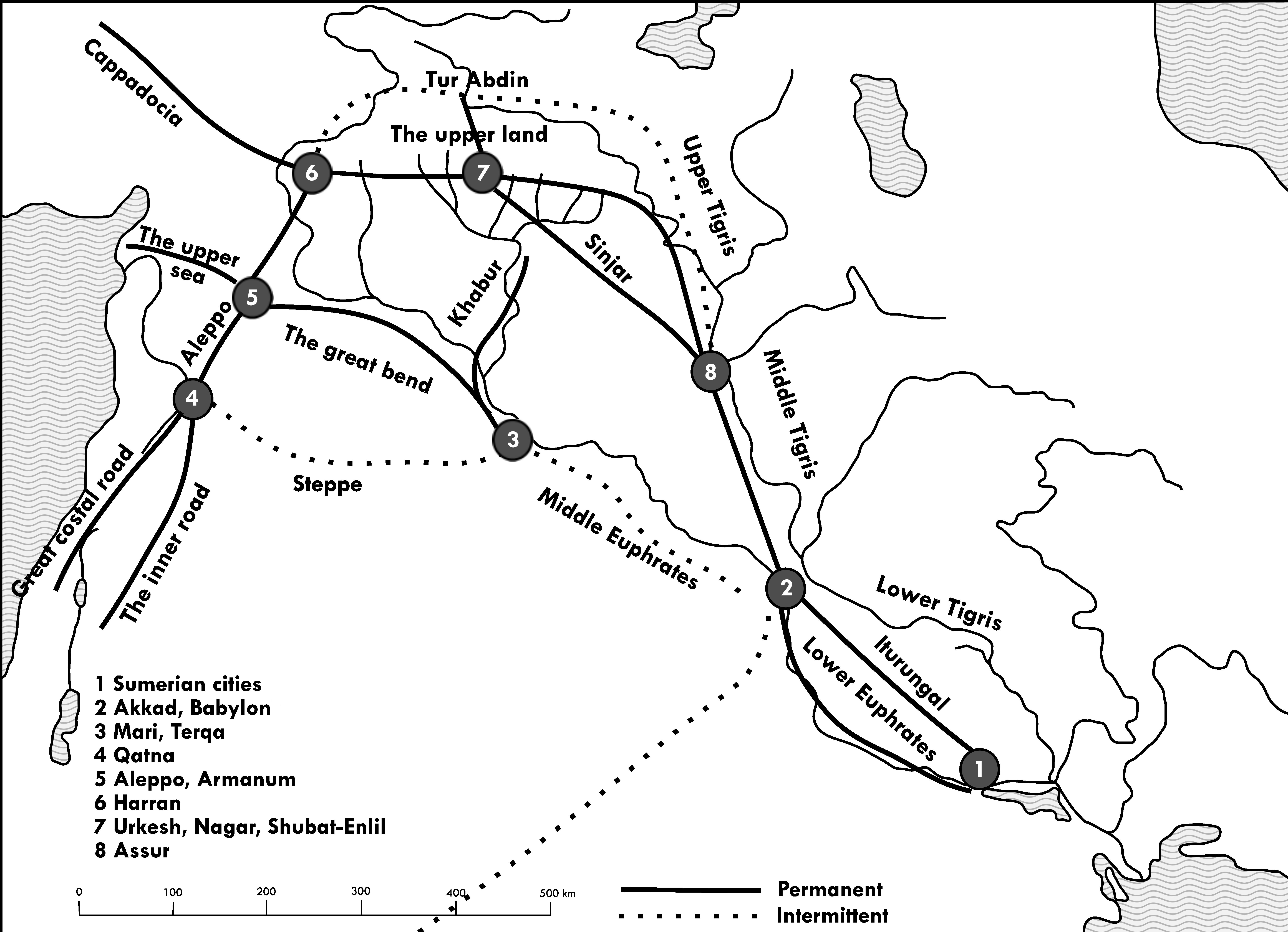
- Map 4: The great communication routes
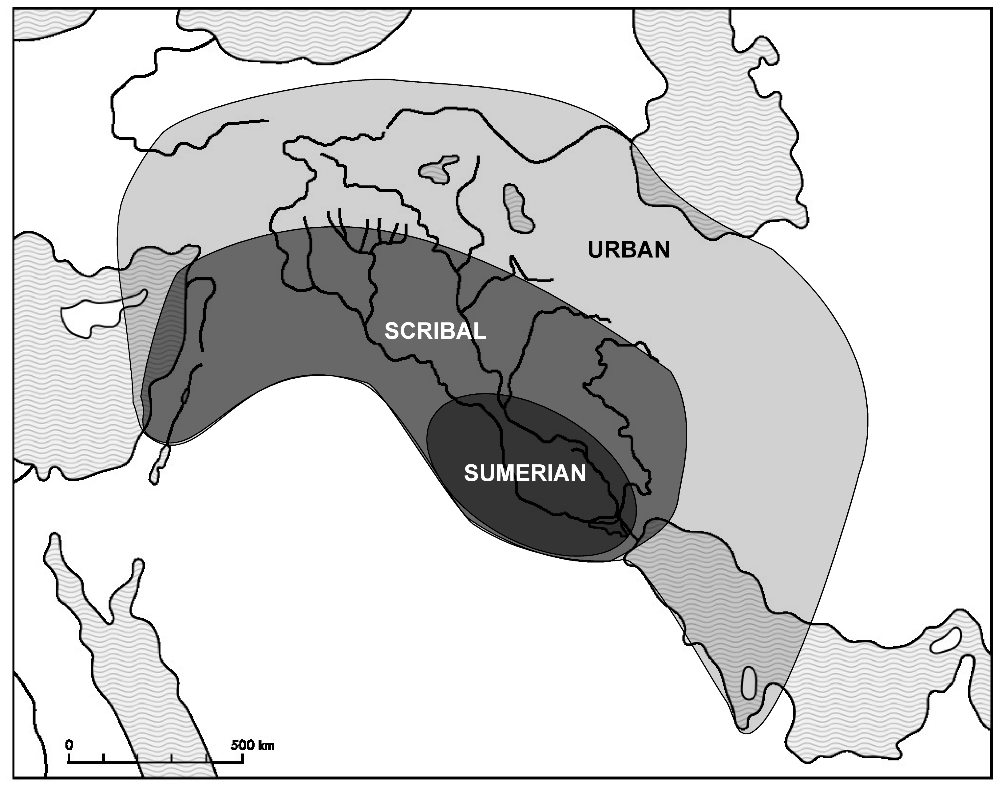
- Map 5: The three ecumene
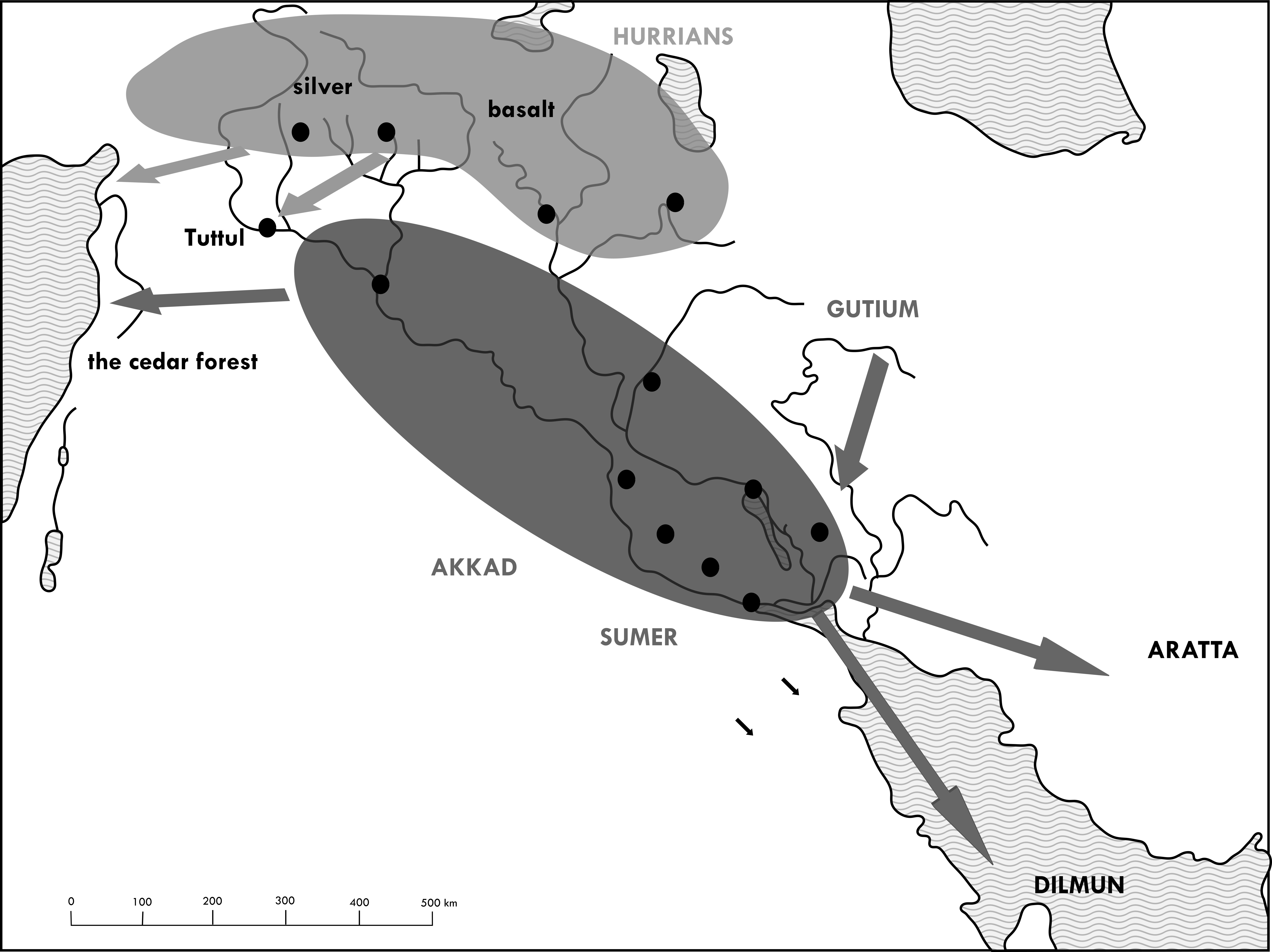
- Map 6: The ideological landscapes
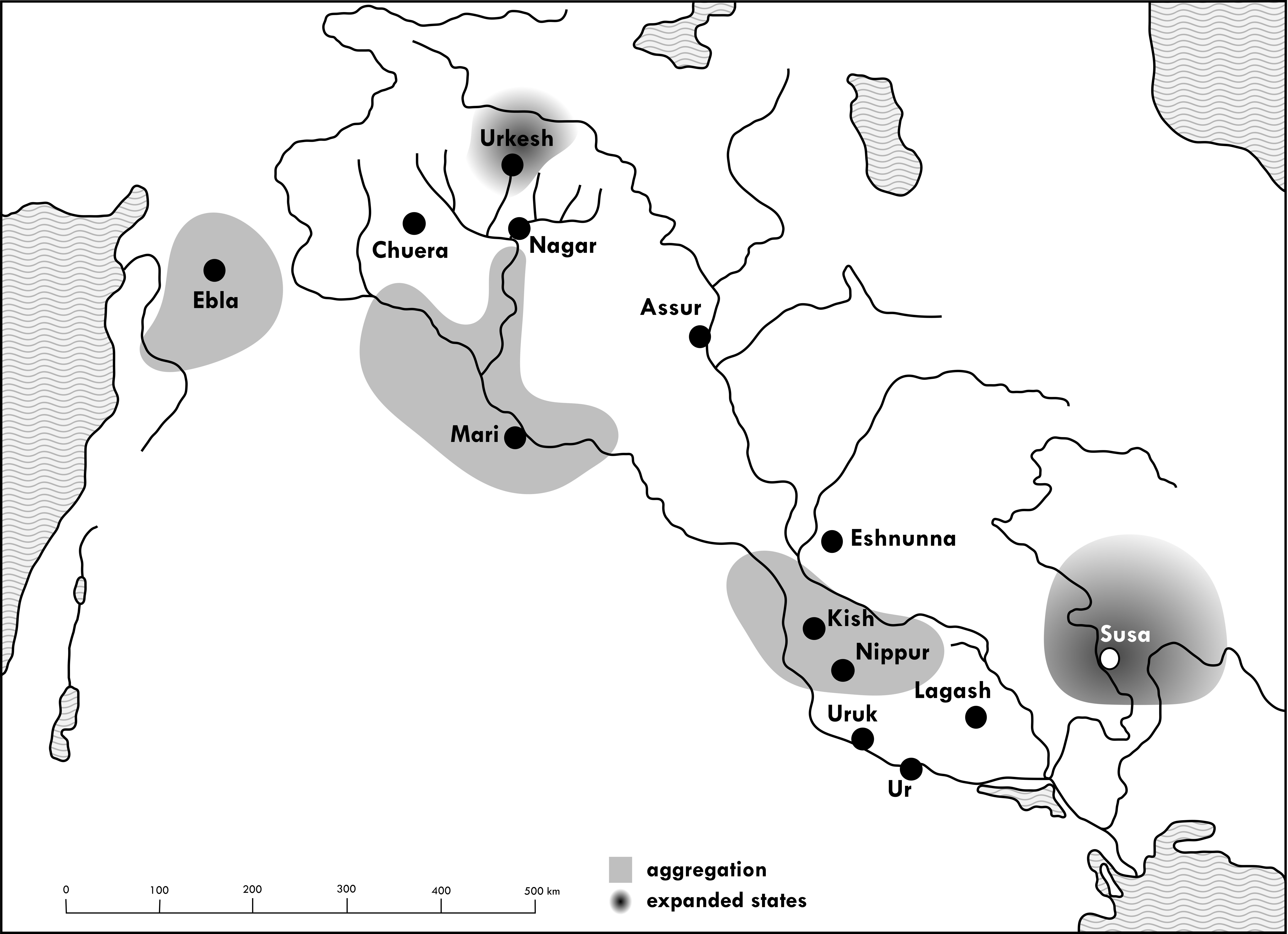
- Map 7: Nuclear and expanded states (3500-2500 BC)
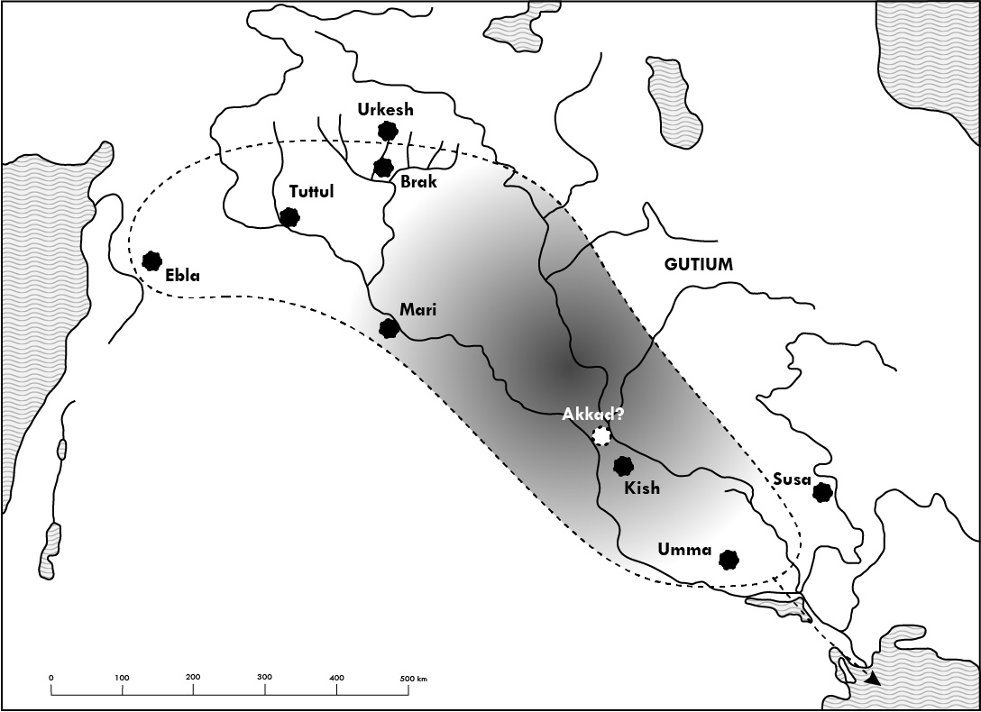
- Map 8: The Akkadian experiment: integration of heterogeneous elements (2300-2200 BC)
- Map 9: The Sumerian unification: the reign of Ur III (2100-2000 BC)
- Map 10: The first split: Isin and Larsa (2000-1800 BC)
- Map 11: The first multi-regional state: Assur and Mari (1800 BC)
- Map 12: The Babylonian unification: the kingdom of Hammurapi (1750 BC)
- Map 13: Interpretive models of Amorite movements (2100-1600 BC)
- Map 14: The Near East on the eve of cosmopolis (1600 B.C.)
- Map 15: The expansion of the kingdom of Khana to the steppe (1750-1600 BC)
- Map 16: Amurru, the first steppe kingdom (1500-1200 BC)
- Map 17: The geographical basis of the cosmopolis
- Map 18: The cosmopolis (1500-1400 BC)
- Map 19: The cosmopolis (1400-1300 BC)
- Map 20: The cosmopolis (1300-1200 BC)
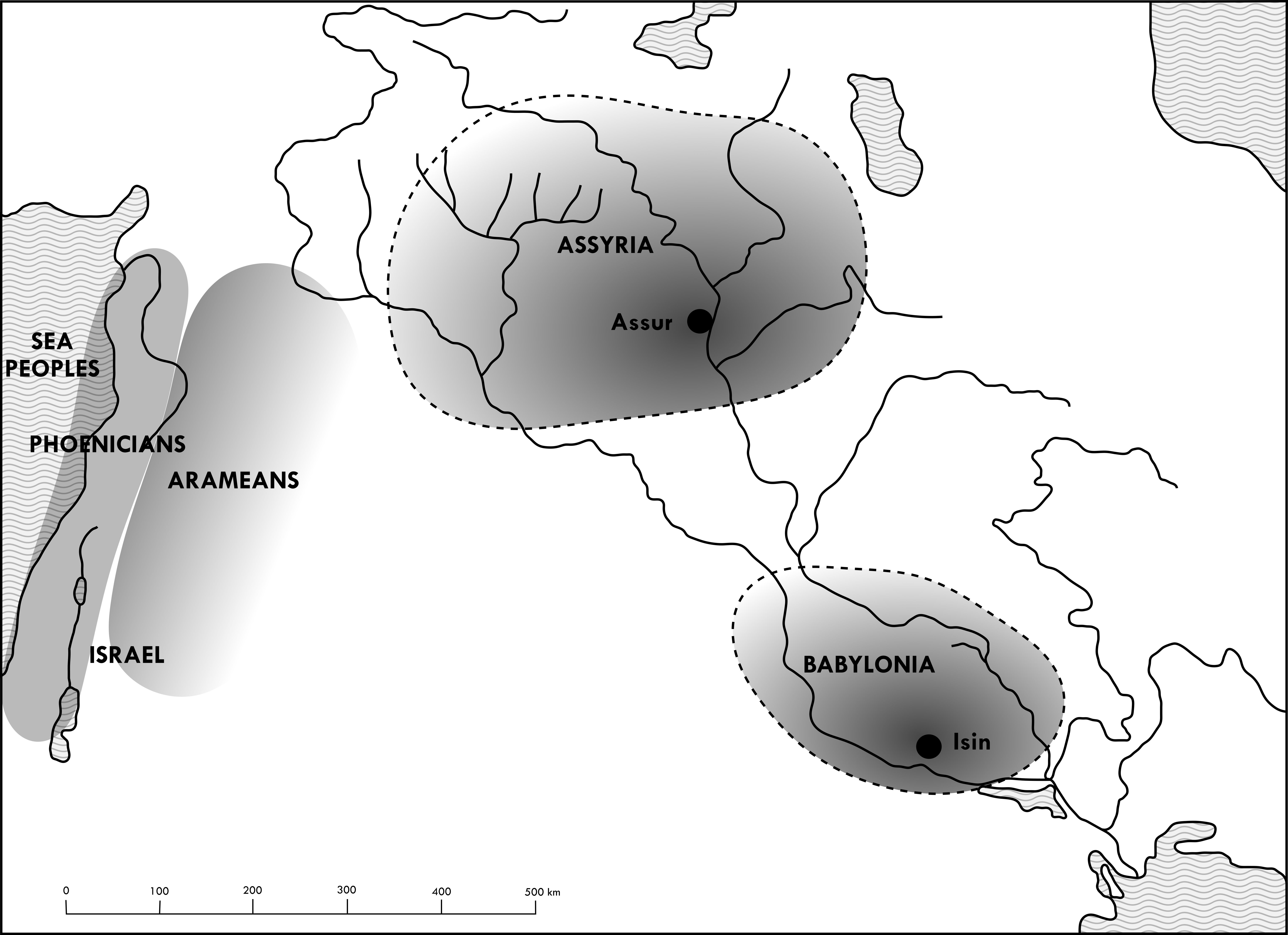
- Map 21: The re-establishment of the multi-region: the Assyrian ecumene (911-859 BC)
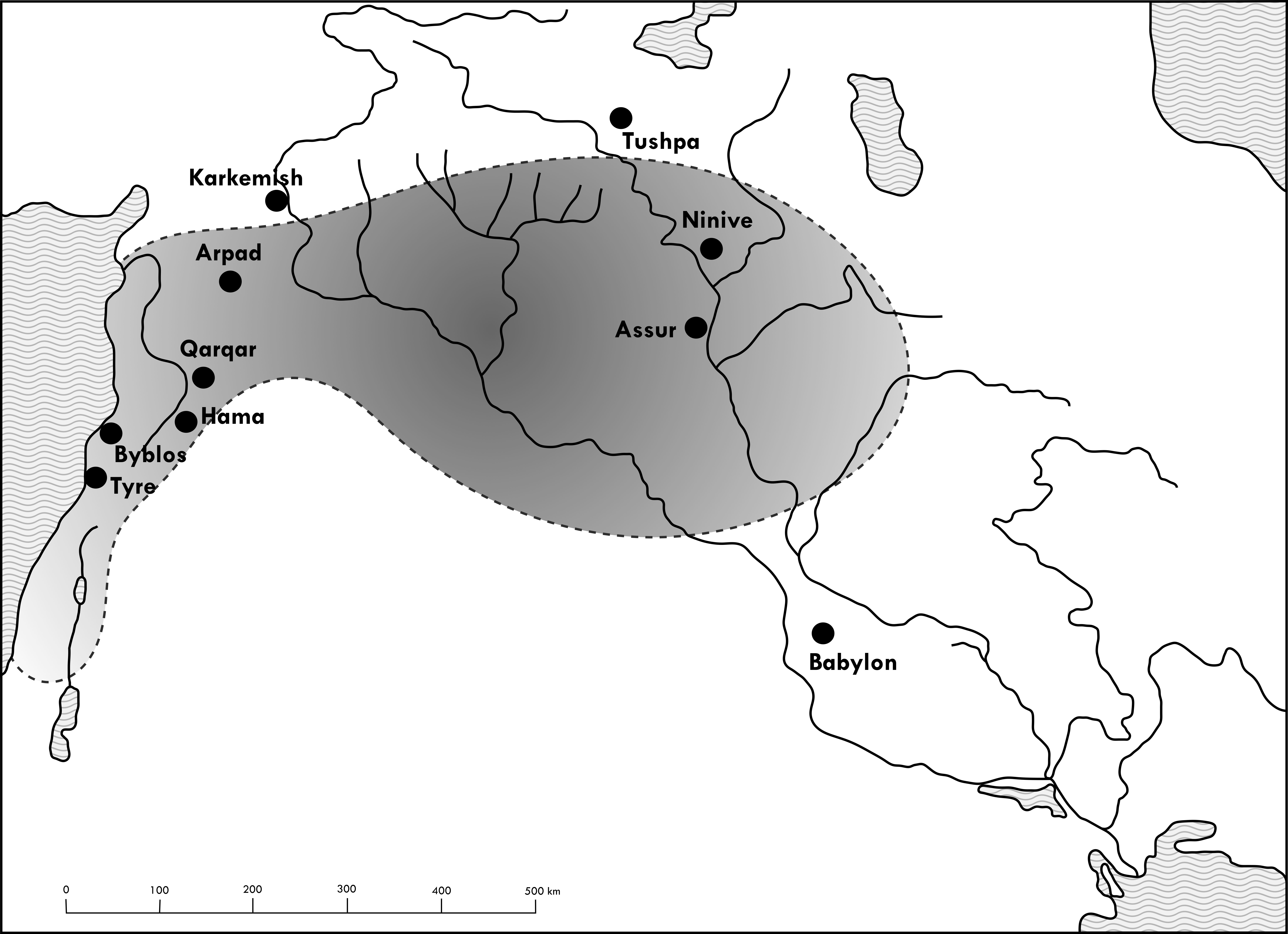
- Map 22: The reconstitution of Syro-Mesopotamia: the Aramaic ecumene (745-681 BC)
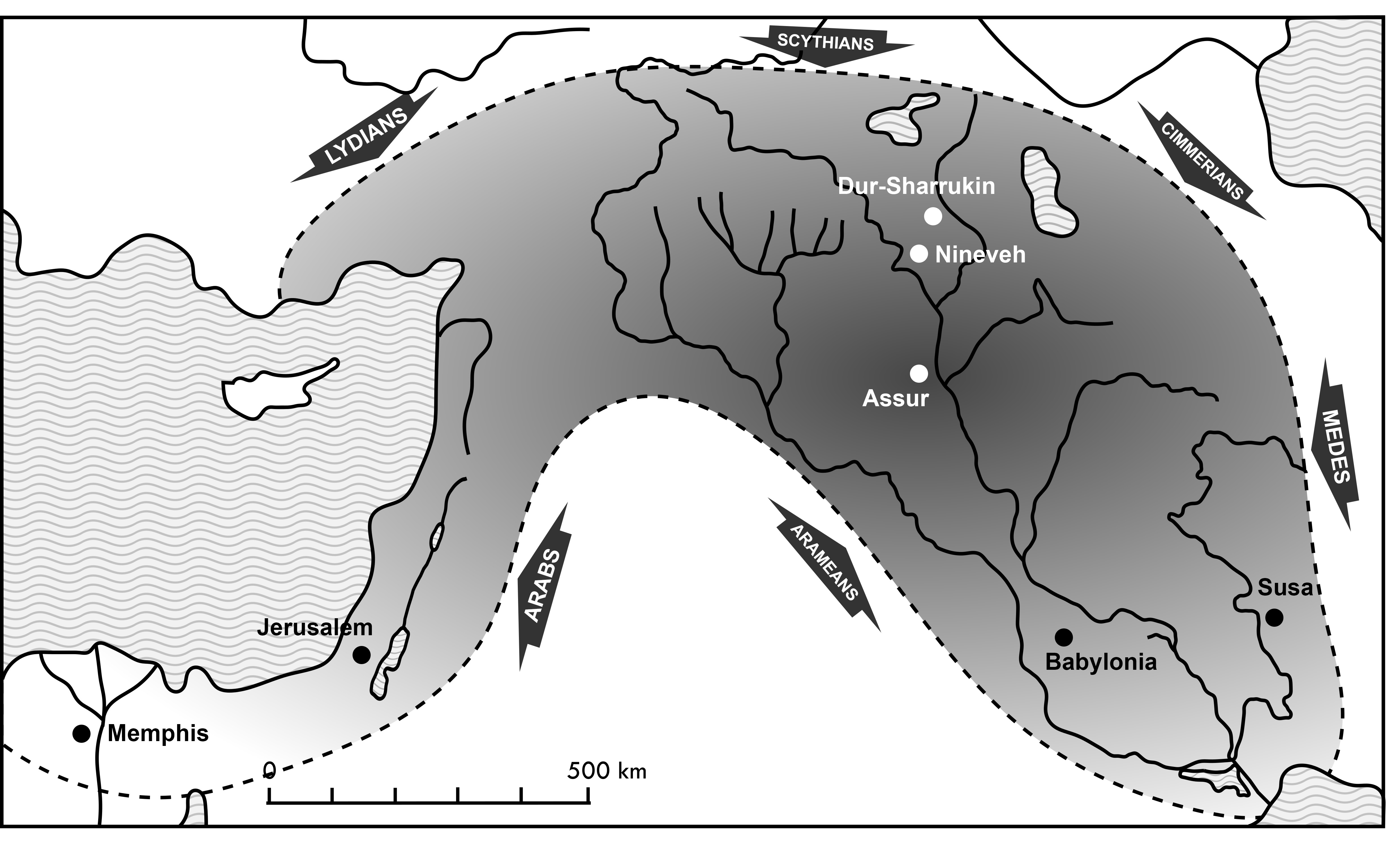
- Map 23: The reconstitution of the cosmopolis: the imperial ecumene (680-629 BC)
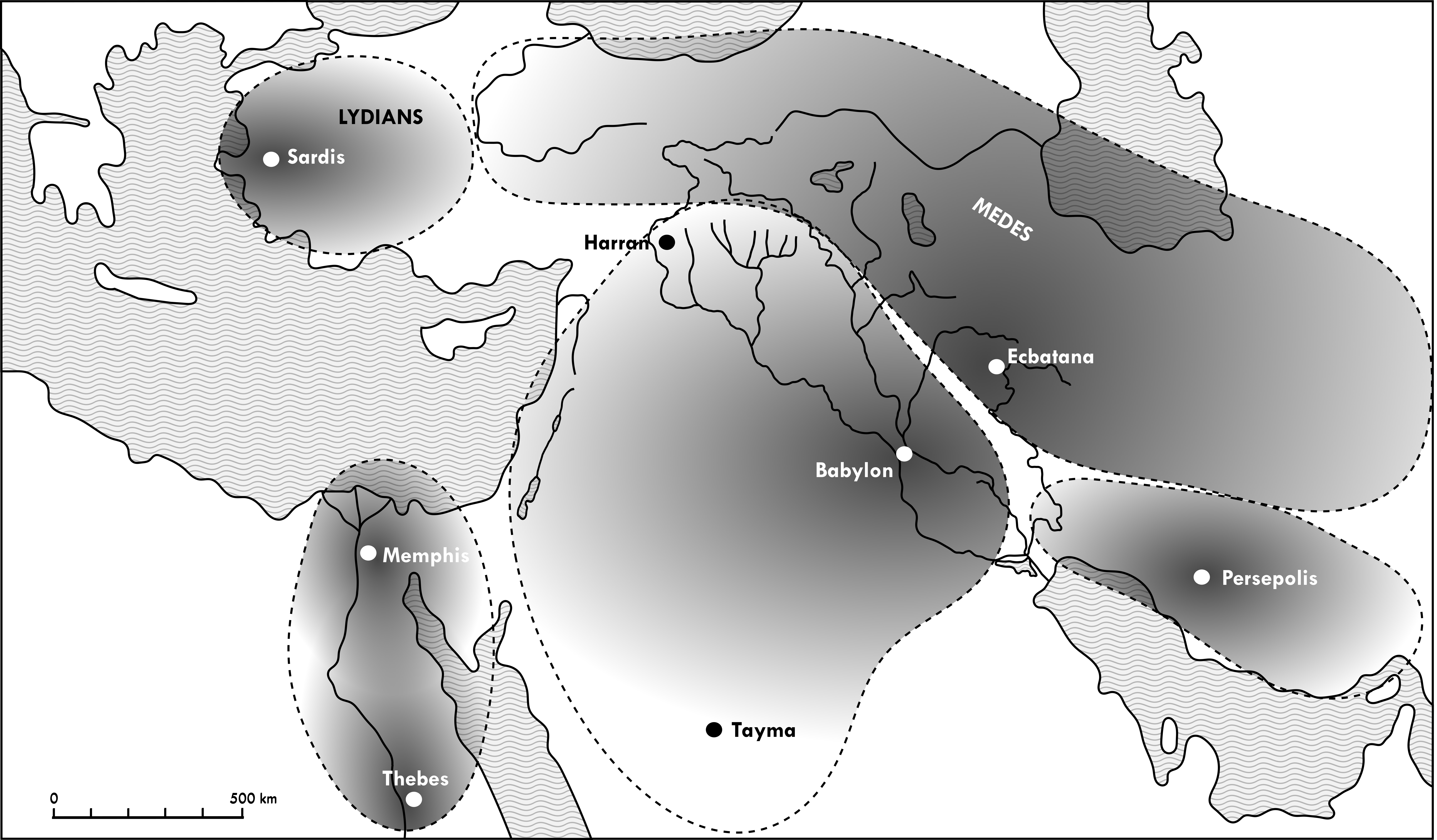
- Map 24: The territorialization of the frontiers (612-539 BC)
[NB: to be left only if copyright will allow; otherwise to be changed with other versions (ZHy07 mDP)]
NOTES:
- click on maps to open them larger in a new tab;
- for further information about ancient cities and they location, cf. U N E S C O- W H C.
Back to top: Resources
Introduction
This page displays the geographical maps published at the end of the volume At the Origins of Politics.
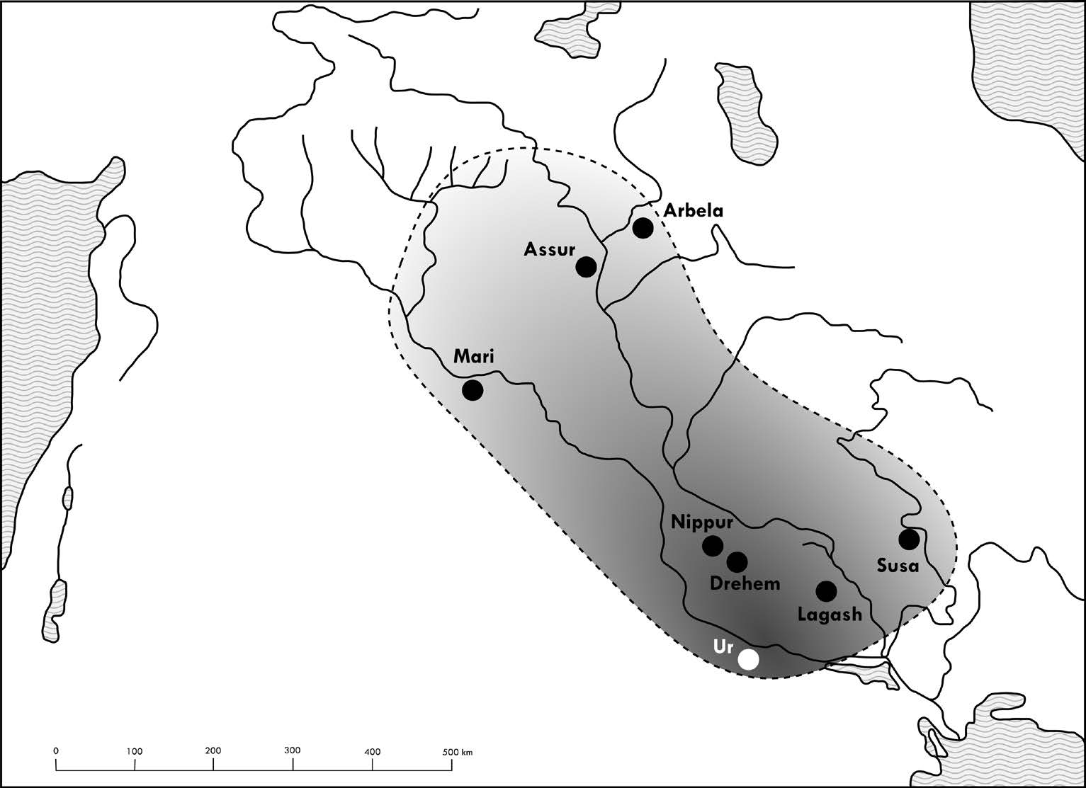
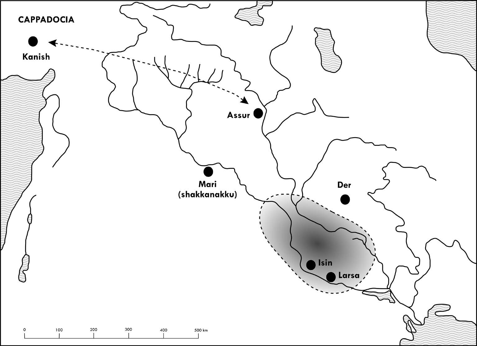
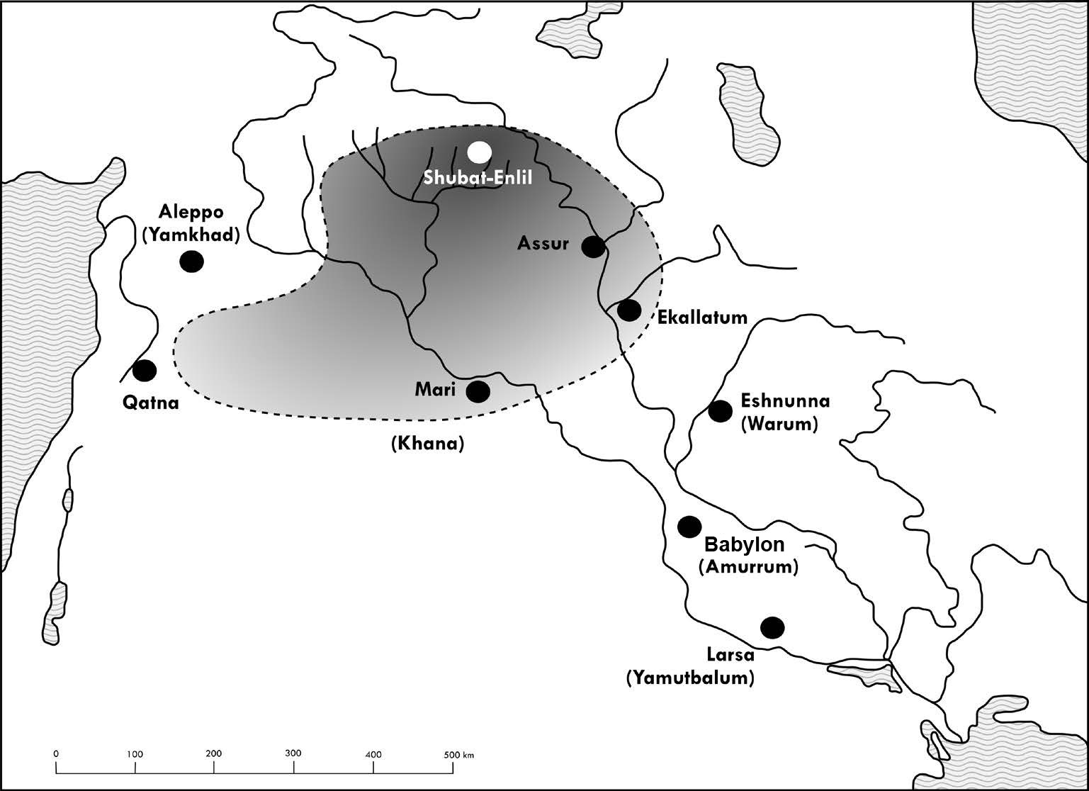
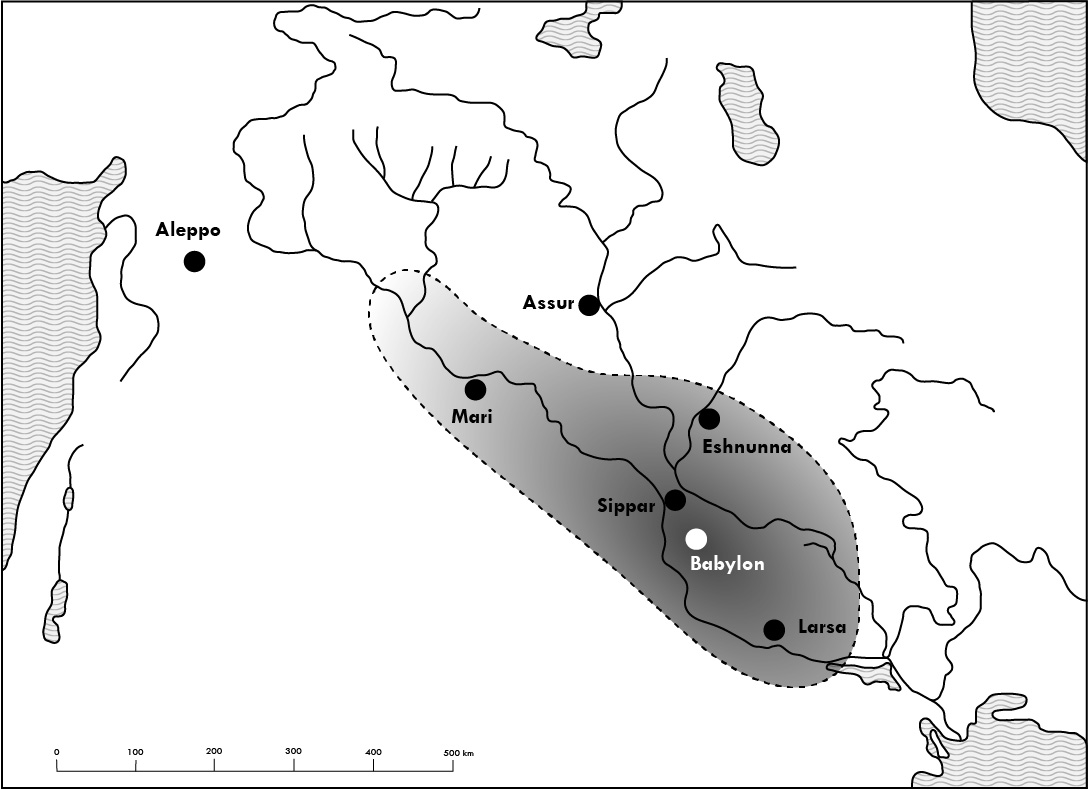
The function of maps is to give a basic geographical orientation to the reader by locating the main geo-political configurations of Syro-Mesopotamia in time and space.
But they are also intended to facilitate the understanding of the spatial realities that are central to the argument of this book. In this perspective, institutional development is closely related to the perception of the territory and the nature of the control that is exercised over it by people.
The choice of subjects as well as the captions accompanying the maps are conceived not only to identify the subject of each particular map, but also to provide a reminder of certain aspects from the argumentation that are particularly based on the more properly geo-political aspects.
The cartographic representation is deliberately impressionistic in nature, and is intended primarily to give a sense of the proportions of the territorial entities at issue. The nature of political boundaries is an important topic, which is discussed several times in the text (2.3, 3.2, 5.4).
The chosen representation style has the purpose to give a sense of geo-political realities, while maintaining at the same time the necessary nuances. Thus, the borders are dashed, and the inner area is indicated with a graphic gradient that becomes progressively more nuanced to the extent that one moves away from the center (political, not necessarily geographical).
The graphic realization of the maps is by Laerke Recht.
Back to top: Resources
Map 1: Oro- and hydrography
Back to top: Resources
Map 2: The three climatic zones
Back to top: Resources
Map 3: The “Land of the Four River Banks”
Back to top: Resources
Map 4: The great communication routes
Back to top: Resources
Map 5: The three ecumene
Back to top: Resources
Map 6: The ideological landscapes
Back to top: Resources
Map 7: Nuclear and expanded states (3500-2500 BC)
Back to top: Resources
Map 8: The Akkadian experiment: integration of heterogeneous elements (2300-2200 BC)
Back to top: Resources
Map 9: The Sumerian unification: the reign of Ur III (2100-2000 BC)
Back to top: Resources
Map 10: The first split: Isin and Larsa (2000-1800 BC)
Back to top: Resources
Map 11: The first multi-regional state: Assur and Mari (1800 BC)
Back to top: Resources
Map 12: The Babylonian unification: the kingdom of Hammurapi (1750 BC)
Back to top: Resources
Map 13: Interpretive models of Amorite movements (2100-1600 BC)
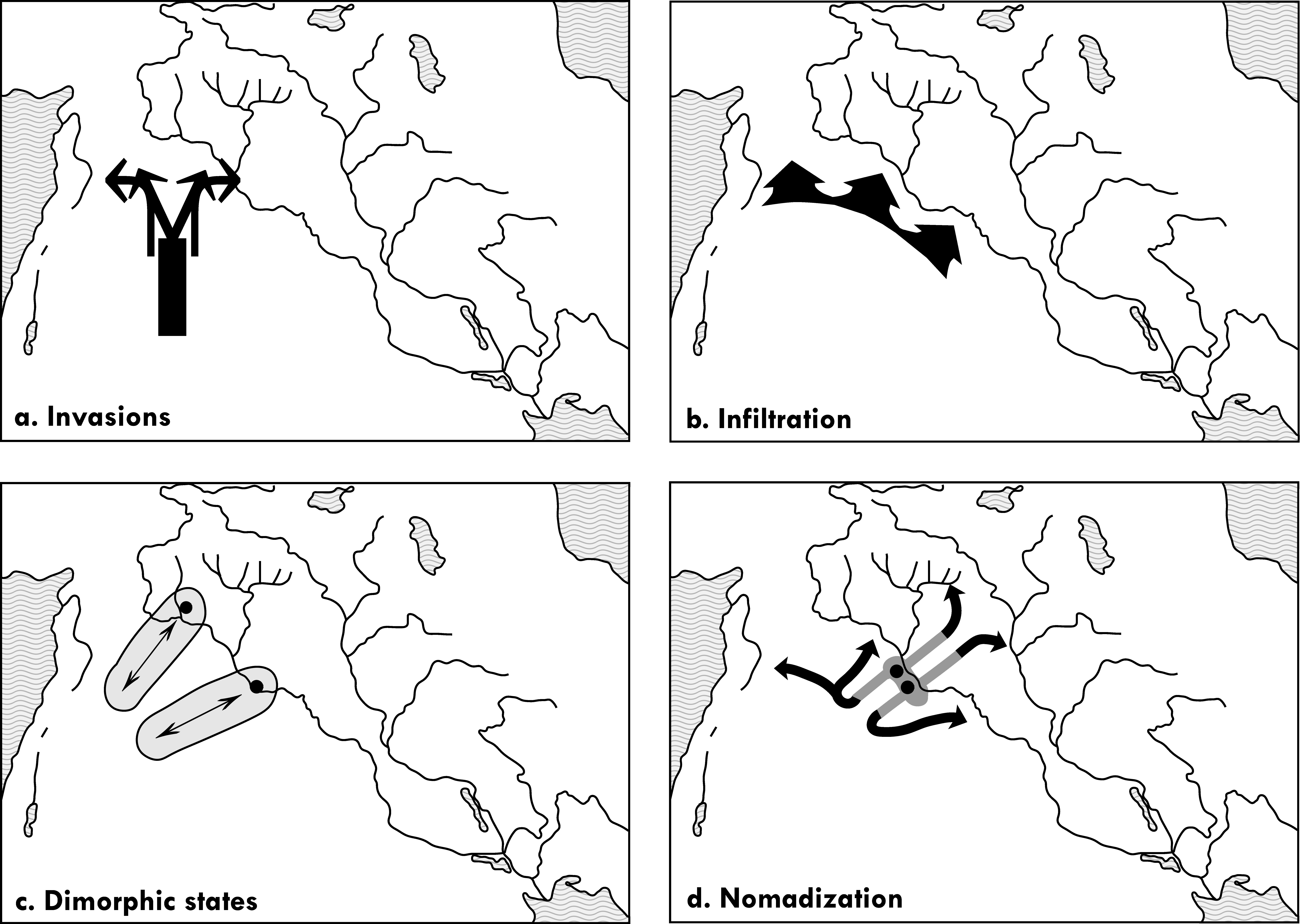
Back to top: Resources
Map 14: The Near East on the eve of cosmopolis (1600 B.C.)
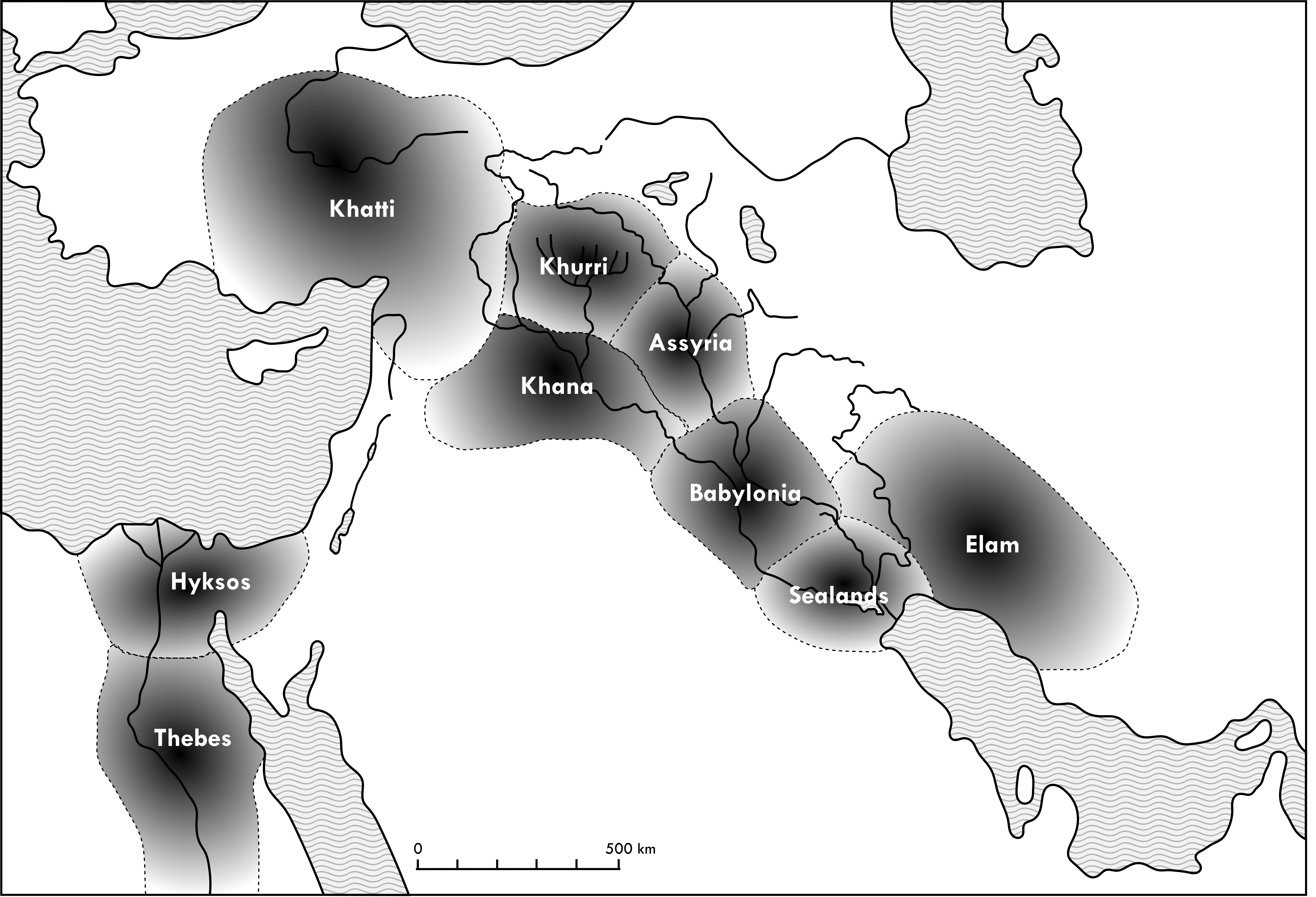
Back to top: Resources
Map 15: The expansion of the kingdom of Khana to the steppe (1750-1600 BC)
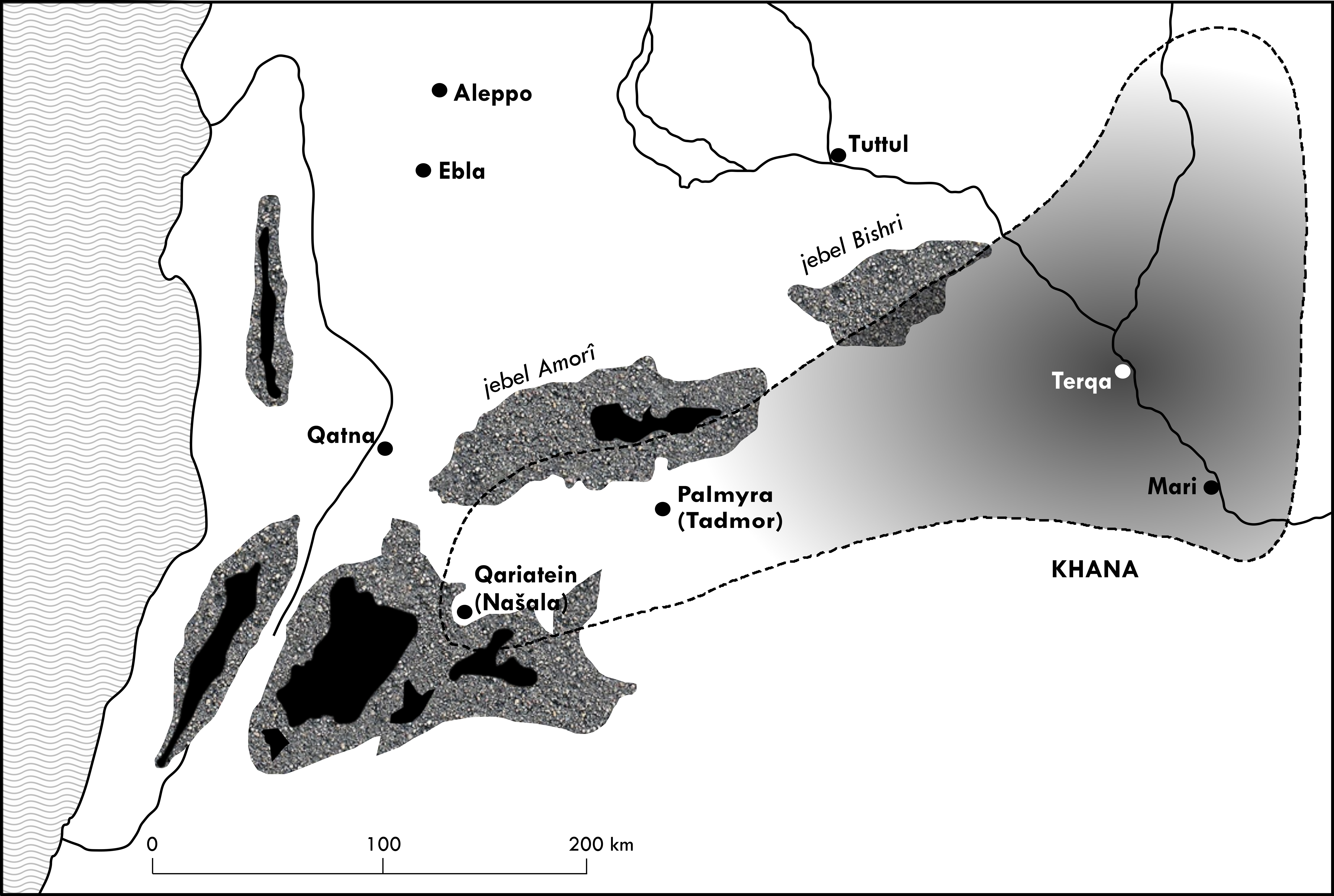
Back to top: Resources
Map 16: Amurru, the first steppe kingdom (1500-1200 BC)
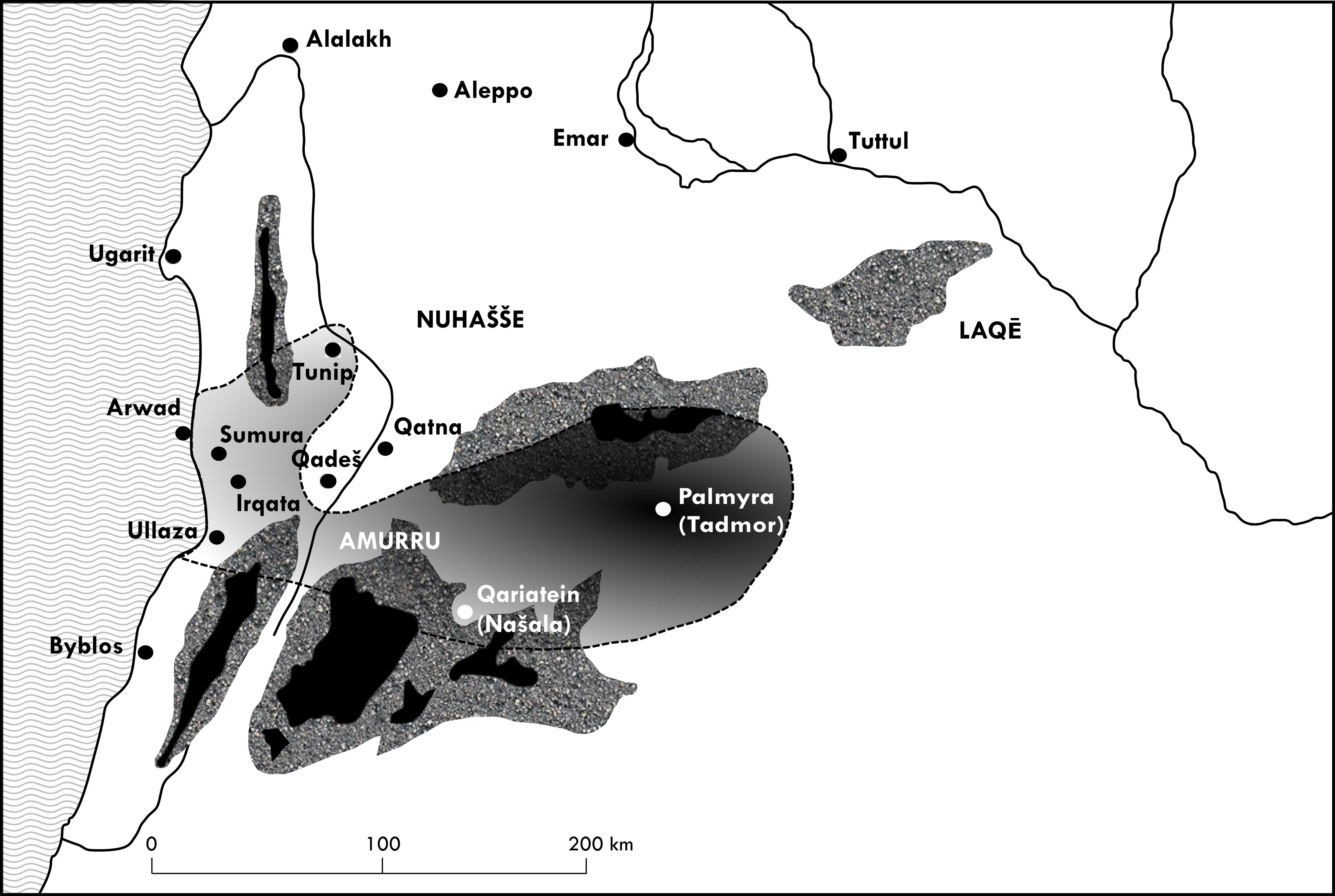
Back to top: Resources
Map 17: The geographical basis of the cosmopolis
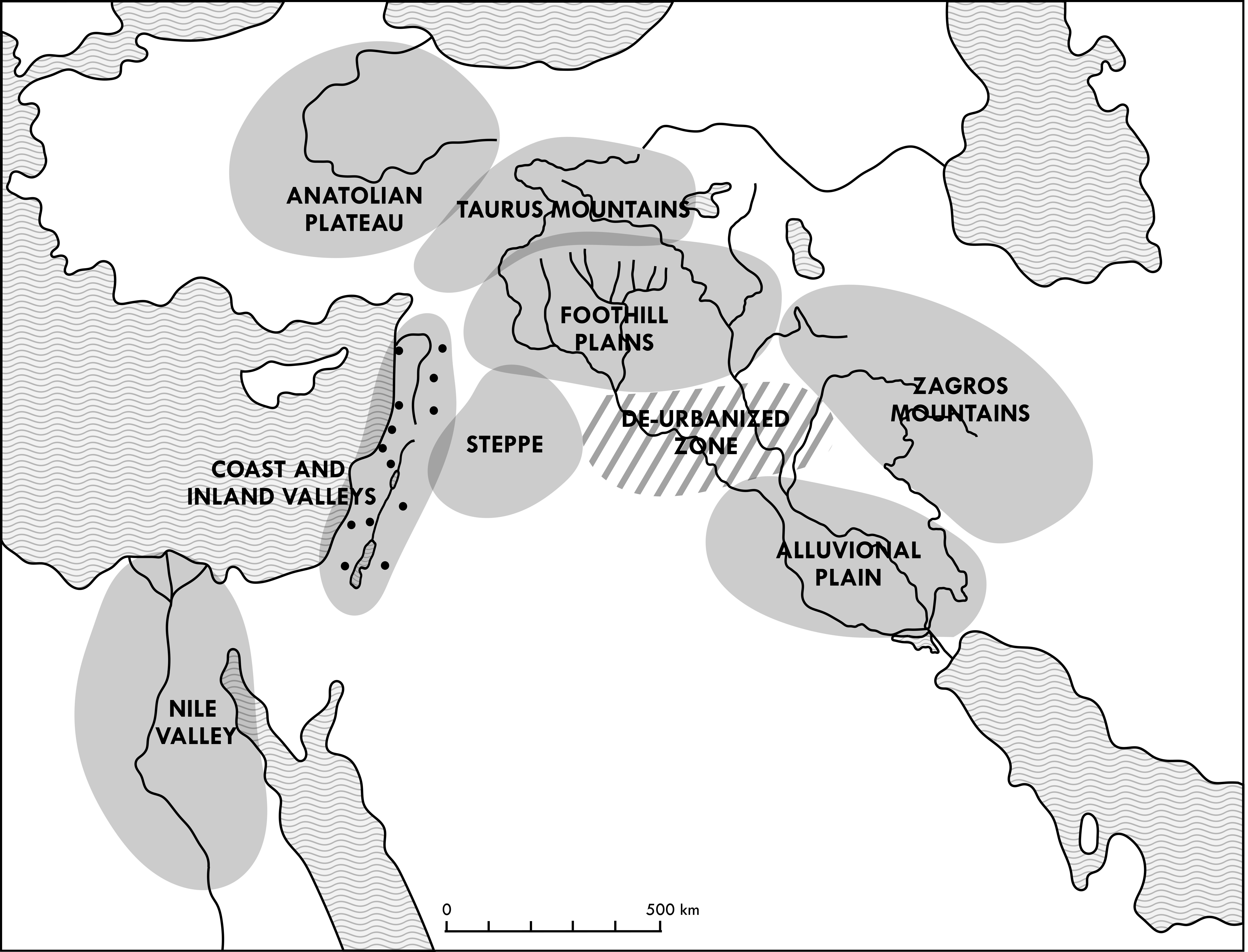
Back to top: Resources
Map 18: The cosmopolis (1500-1400 BC)
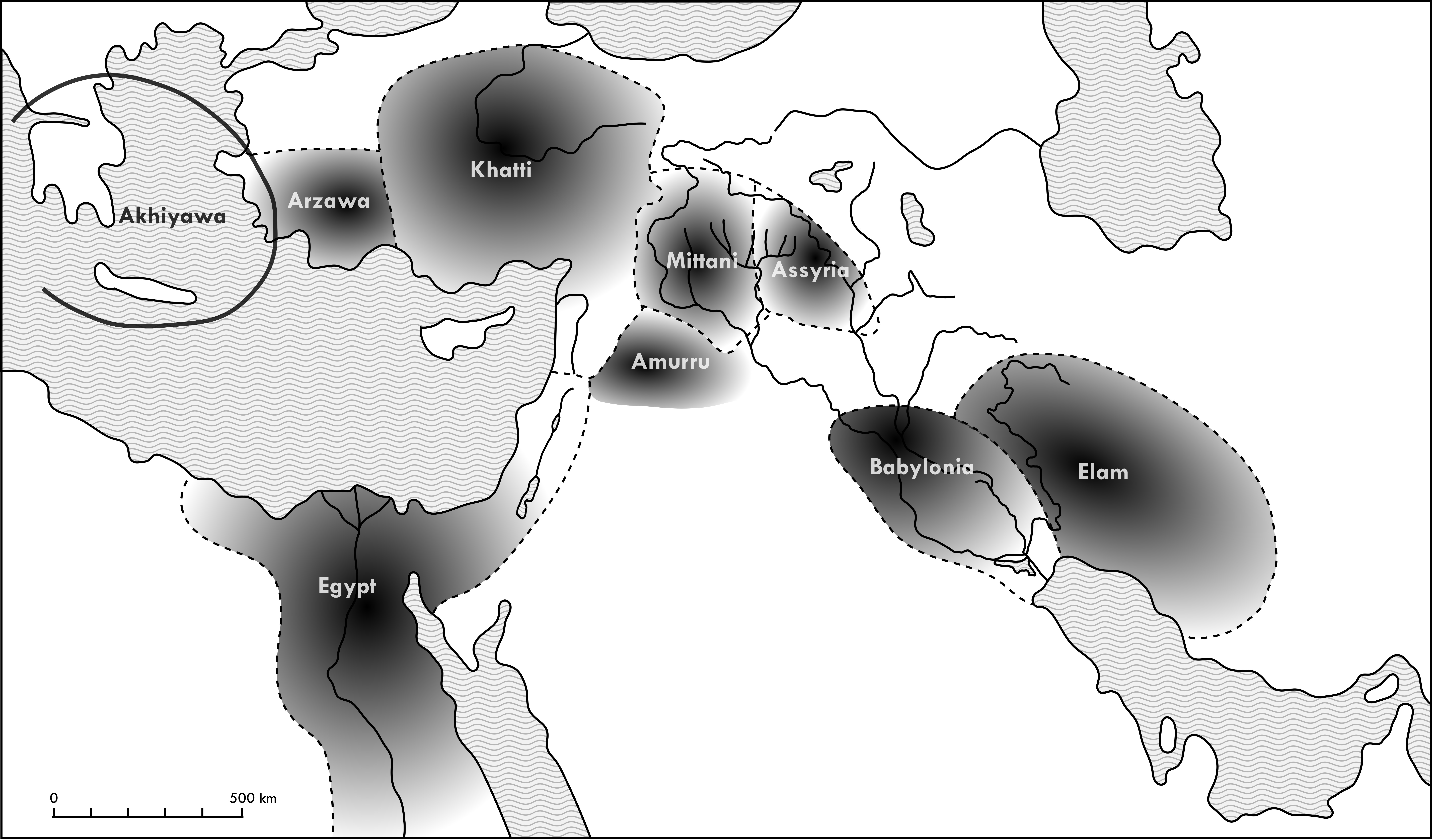
Back to top: Resources
Map 19: The cosmopolis (1400-1300 BC)
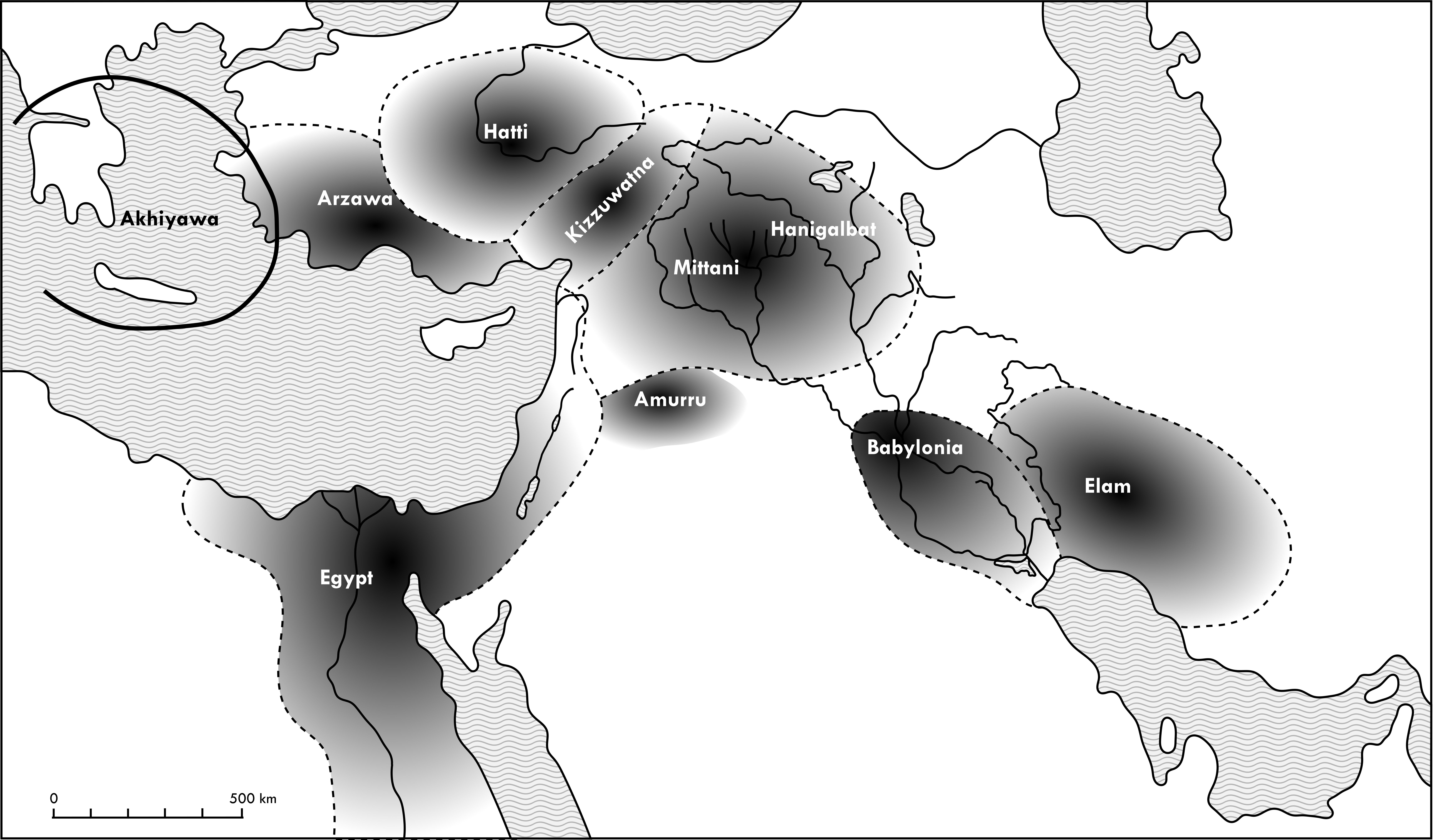
Back to top: Resources
Map 20: The cosmopolis (1300-1200 BC)
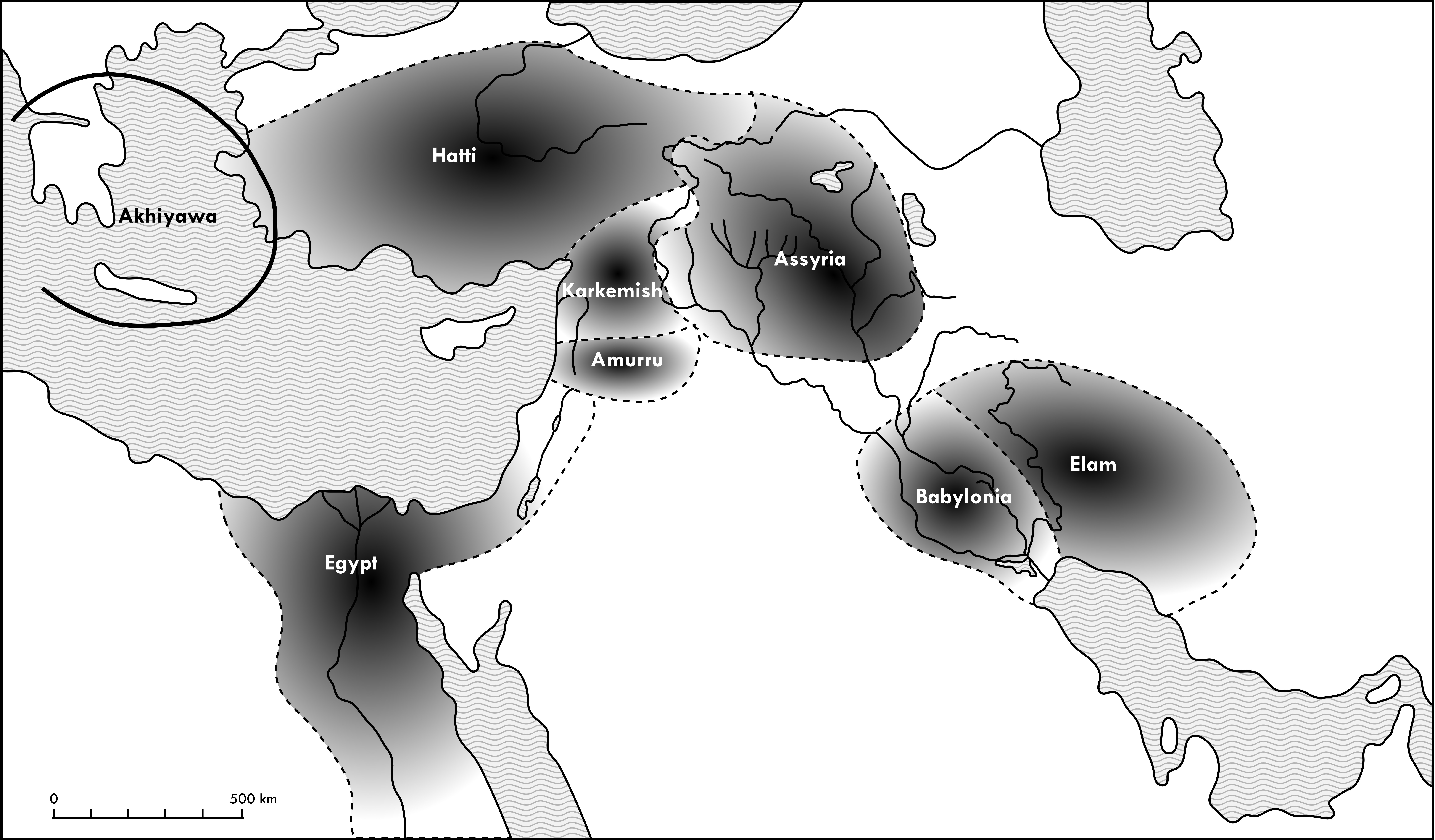
Back to top: Resources
Map 21: The re-establishment of the multi-region: the Assyrian ecumene (911-859 BC)
Back to top: Resources
Map 22: The reconstitution of Syro-Mesopotamia: the Aramaic ecumene (745-681 BC)
Back to top: Resources
Map 23: The reconstitution of the cosmopolis: the imperial ecumene (680-629 BC)
Back to top: Resources
Map 24: The territorialization of the frontiers (612-539 BC)
Back to top: Resources