[NB: STUB page; the selection of figures is not yet defined; in any case, they do not necessarily correspond to figures in the Origins volume (references to figures in the book will be provided) (ZHy07 mDP)]
NOTE: click on figures to open them larger in a new tab
Back to top: Resources
Introduction
This page displays some figures published in the volume At the Origins of Politics, while others are not present in the printed book.
Back to top: Resources
Figure 1a: Ancient Syro-Mesopotamia
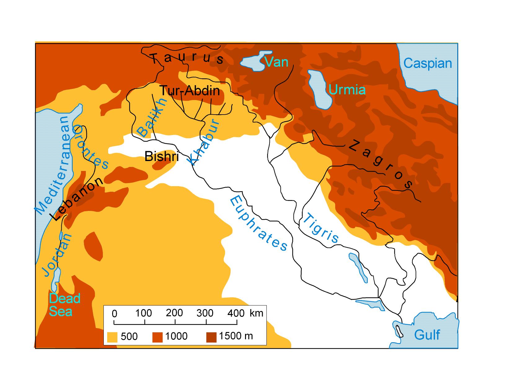 Ancient Syro-Mesopotamia with indication of the most important regions and geographical entities
### Figure 1b: Modern countries in Syro-Mesopotamia {#1b TO="Syro-Mesopotamia: modern"}
Ancient Syro-Mesopotamia with indication of the most important regions and geographical entities
### Figure 1b: Modern countries in Syro-Mesopotamia {#1b TO="Syro-Mesopotamia: modern"}
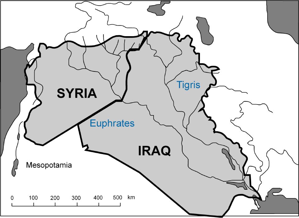 Modern countries insisting on the area of ancient Syro-Mesopotamia with indication of modern countries' borders
### Figure 2a: The "trimorphic" landscape {#2a TO="trimophic geography"}
Modern countries insisting on the area of ancient Syro-Mesopotamia with indication of modern countries' borders
### Figure 2a: The "trimorphic" landscape {#2a TO="trimophic geography"}
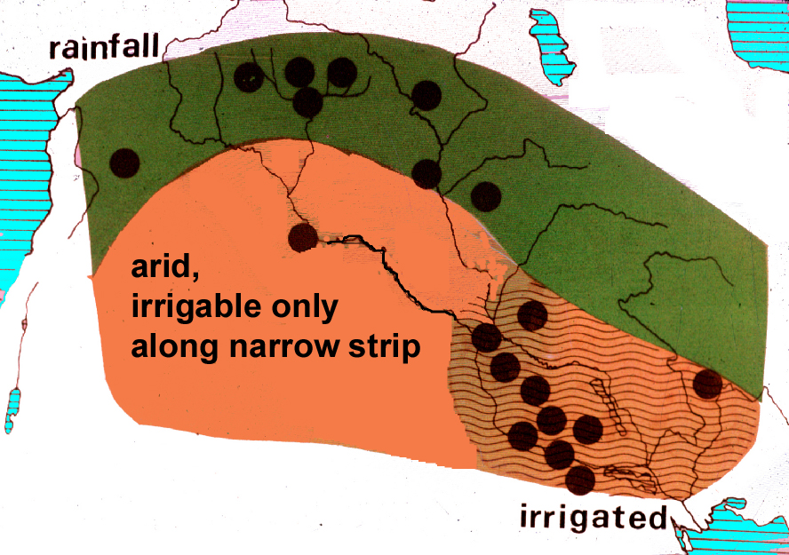 Ancient Syro-Mesopotamia presented a kind of "trimorphic" landscape, characterized by rainfall in the North, an arid and poorly irrigable area to the South-West, and an irrigated zone in the South-East
### Figure 2b: The "Fertile Crescent" {#2b TO="Fertile Crescent"}
Ancient Syro-Mesopotamia presented a kind of "trimorphic" landscape, characterized by rainfall in the North, an arid and poorly irrigable area to the South-West, and an irrigated zone in the South-East
### Figure 2b: The "Fertile Crescent" {#2b TO="Fertile Crescent"}
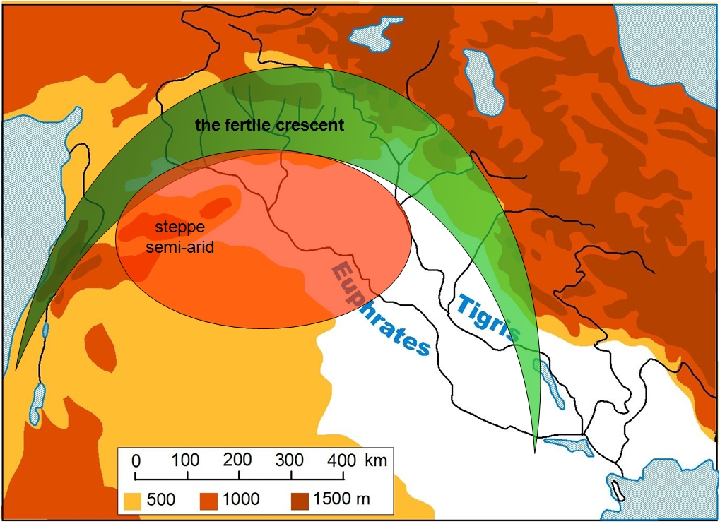 The so-called "Fertle crescent," i.e. the most fertile area in ancient Syro-Mesopotamia
### Figure 2c: Early Transcaucasian sites {#2c TO="Transcaucasian sites"}
The so-called "Fertle crescent," i.e. the most fertile area in ancient Syro-Mesopotamia
### Figure 2c: Early Transcaucasian sites {#2c TO="Transcaucasian sites"}
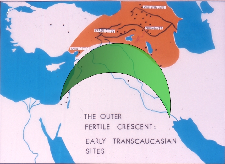 To the North of the "Fertile Crescent," early Transcaucasian sites developed, having contacts to the South already in the 4th millennium BC
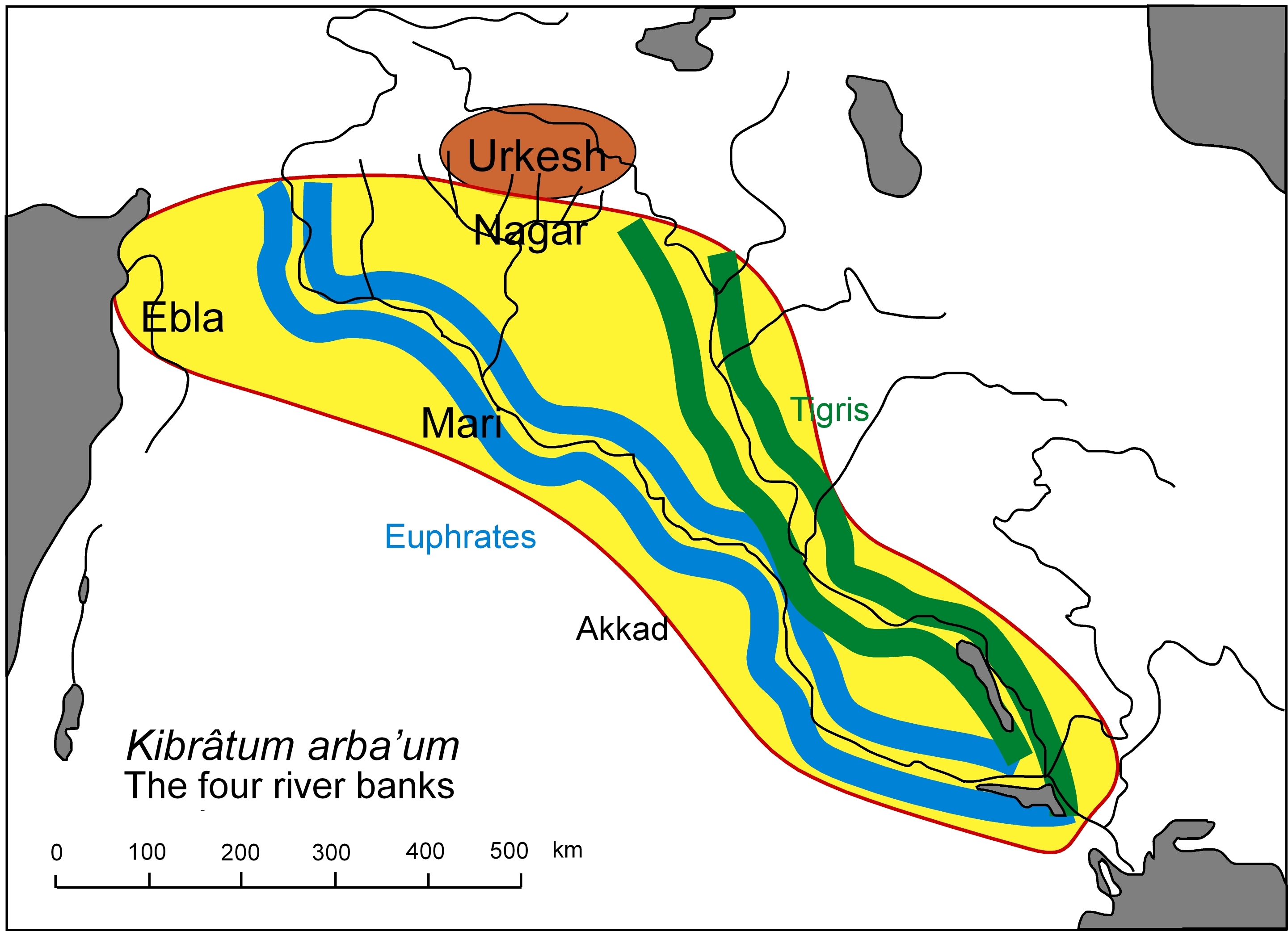
### Figure 3a: The "Four River Banks" {#3a TO="Four River Banks"}
To the North of the "Fertile Crescent," early Transcaucasian sites developed, having contacts to the South already in the 4th millennium BC
### Figure 3a: The "Four River Banks" {#3a TO="Four River Banks"}
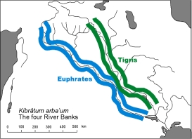 The core area of ancient Mesopotamia was known as the land of the "Four Rover Banks," and was located along the Tigris and the Euphrates rivers
### Figure 3b: Urkesh {#3b TO="Urkesh = Tell Mozan; Tell Mozan = Urkesh"}
The core area of ancient Mesopotamia was known as the land of the "Four Rover Banks," and was located along the Tigris and the Euphrates rivers
### Figure 3b: Urkesh {#3b TO="Urkesh = Tell Mozan; Tell Mozan = Urkesh"}
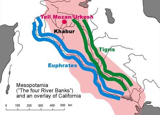 The location of ancient Urkesh/Tell Mozan within the land of the "Four Rover Banks," whose extension is here compared to that of modern California
### Figure 3c: Norther and Southern Mesopotamia {#3c TO="Mesopotamia: South and North"}
The location of ancient Urkesh/Tell Mozan within the land of the "Four Rover Banks," whose extension is here compared to that of modern California
### Figure 3c: Norther and Southern Mesopotamia {#3c TO="Mesopotamia: South and North"}
 Urkesh/Tell Mozan represented in the North (the "Khabur triangle") a parallel phenonemon of urban and state organization and development, contemporary to that happening in Southern Mesopotamia
### Figure 4: Uruk {#4 TO="Uruk; trade; salt; Qraya"}
Urkesh/Tell Mozan represented in the North (the "Khabur triangle") a parallel phenonemon of urban and state organization and development, contemporary to that happening in Southern Mesopotamia
### Figure 4: Uruk {#4 TO="Uruk; trade; salt; Qraya"}
 This figur shown the commercial routes leading from Uruk to the North (towards Malatya, in modern Turkey) and the South (to the region of Susa); note the peculiar spot of Qraya, which was deeply involved in sal production in the 3rd millennium BC (cf. Buccellati 1990a and Buccellati 1990b)
### Figure 5a: The Sumerian core {#5a TO="Sumerian core"}
This figur shown the commercial routes leading from Uruk to the North (towards Malatya, in modern Turkey) and the South (to the region of Susa); note the peculiar spot of Qraya, which was deeply involved in sal production in the 3rd millennium BC (cf. Buccellati 1990a and Buccellati 1990b)
### Figure 5a: The Sumerian core {#5a TO="Sumerian core"}
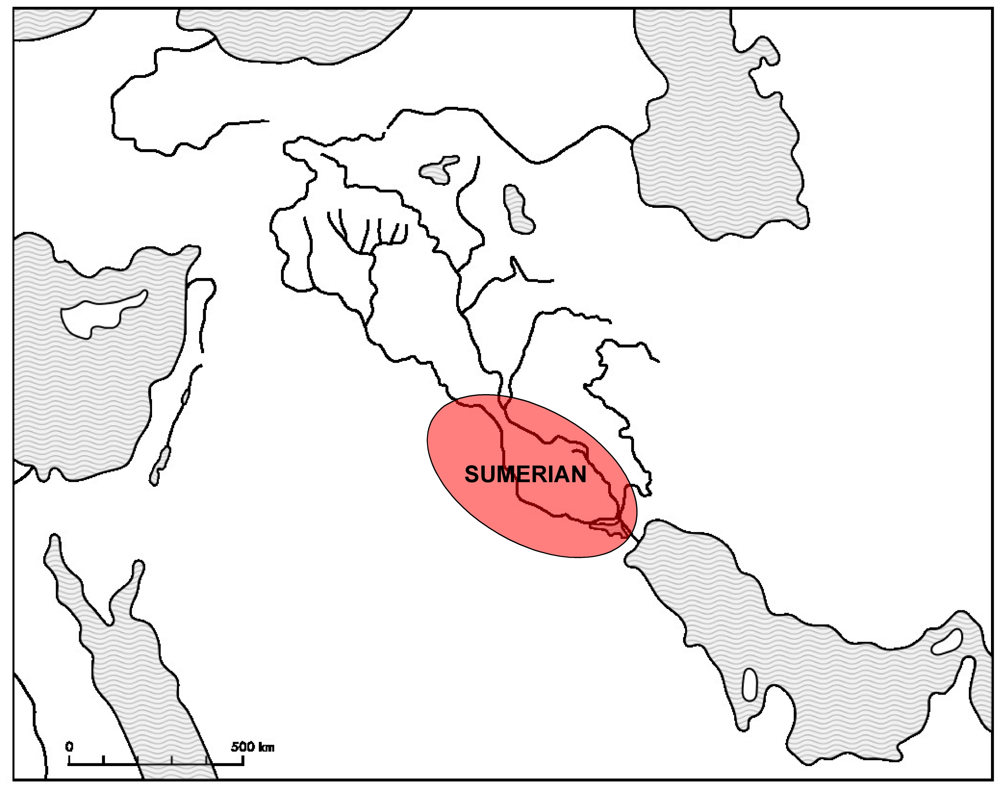 The very core of the Sumerian land was located in southern Mesopotamia
### Figure 5b: The scribal koiné {#5b TO="scribal koiné"}
The very core of the Sumerian land was located in southern Mesopotamia
### Figure 5b: The scribal koiné {#5b TO="scribal koiné"}
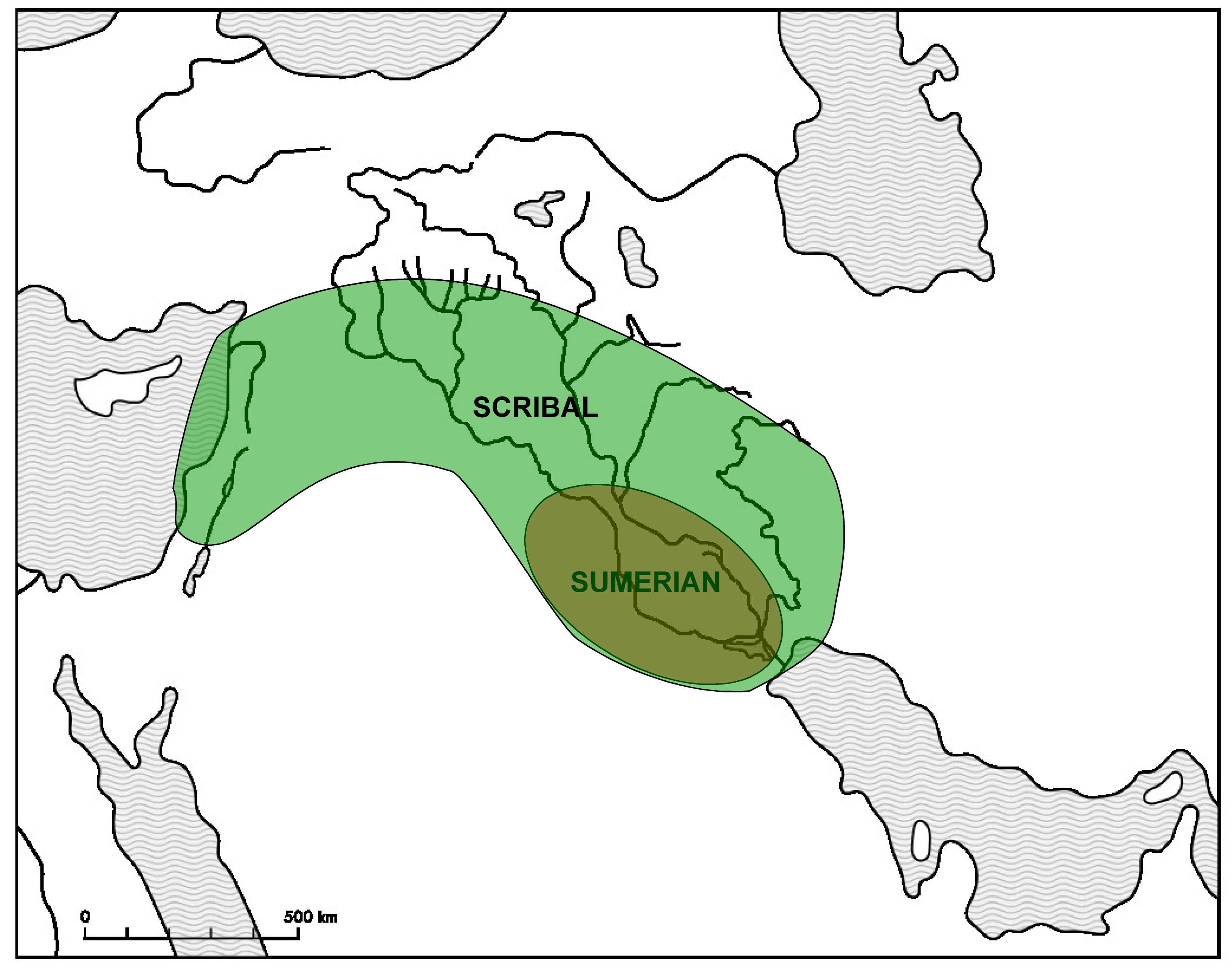 From the Sumerian core, writing was "exported" toward Upper Mesopotamia and Syria, leading to the creation of a variagated "scribal koiné"
### Figure 5c: The urban diffusion {#5c TO="urban diffusion"}
From the Sumerian core, writing was "exported" toward Upper Mesopotamia and Syria, leading to the creation of a variagated "scribal koiné"
### Figure 5c: The urban diffusion {#5c TO="urban diffusion"}
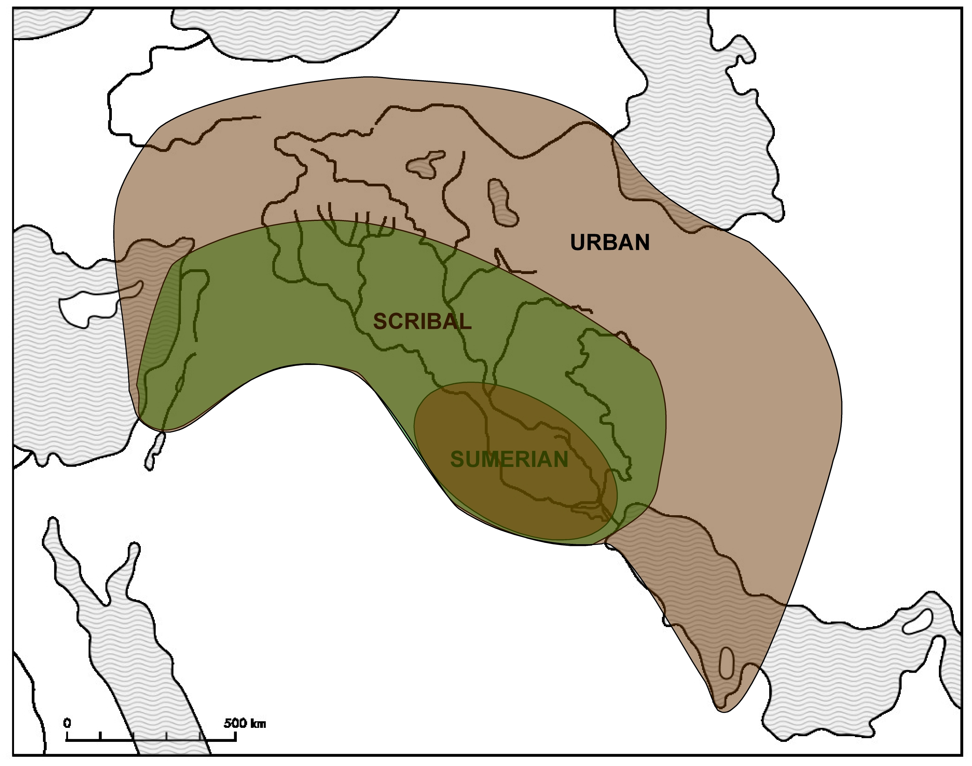 Along with writing, the very idea of urban development spread from its original Sumerian core towards the North, the West, and the South-East
### Figure 5d: Sumerian city-state model {#5d TO="Sumerian city-state model"}
Along with writing, the very idea of urban development spread from its original Sumerian core towards the North, the West, and the South-East
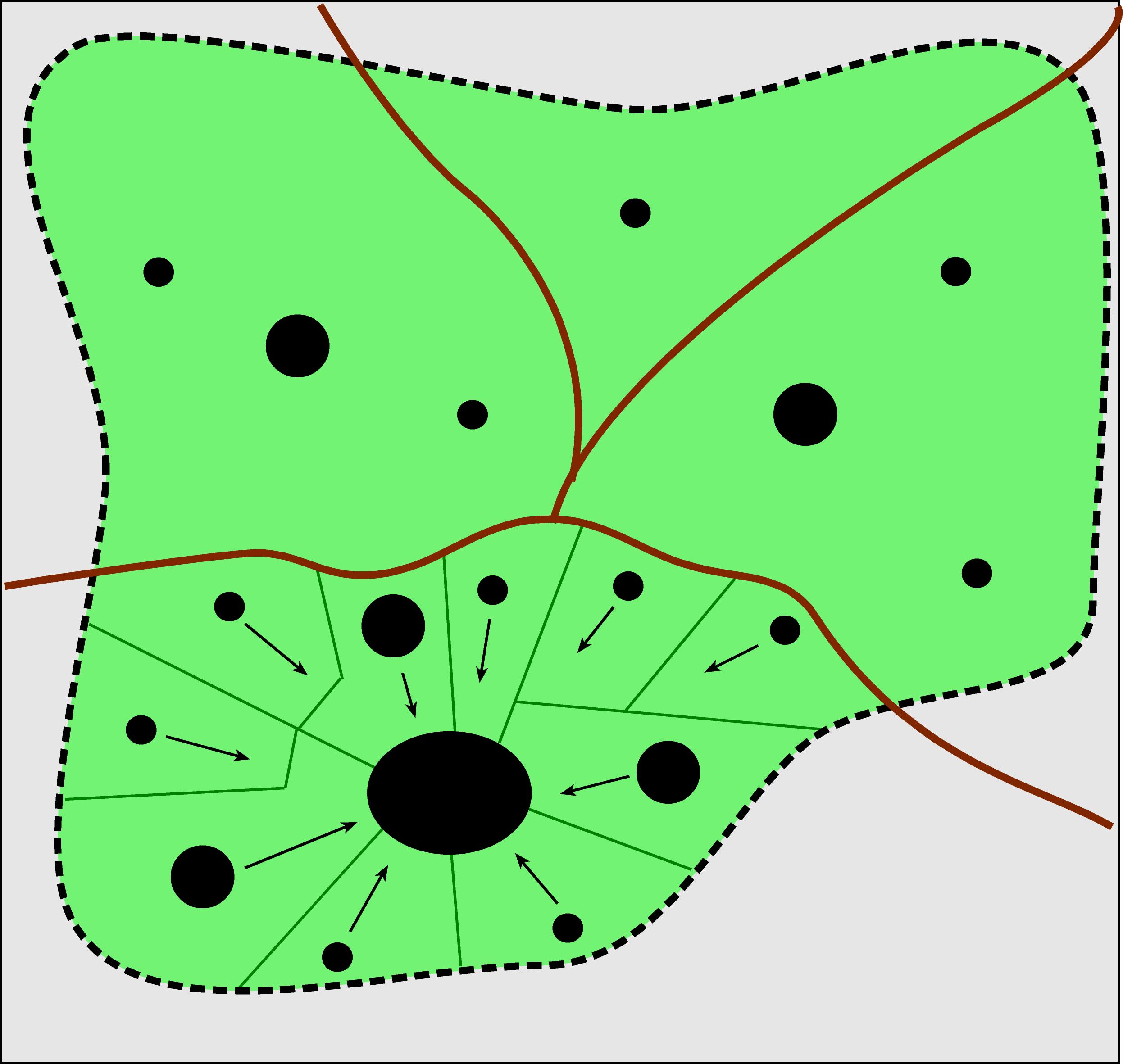
### Figure 5d: Sumerian city-state model {#5d TO="Sumerian city-state model"}
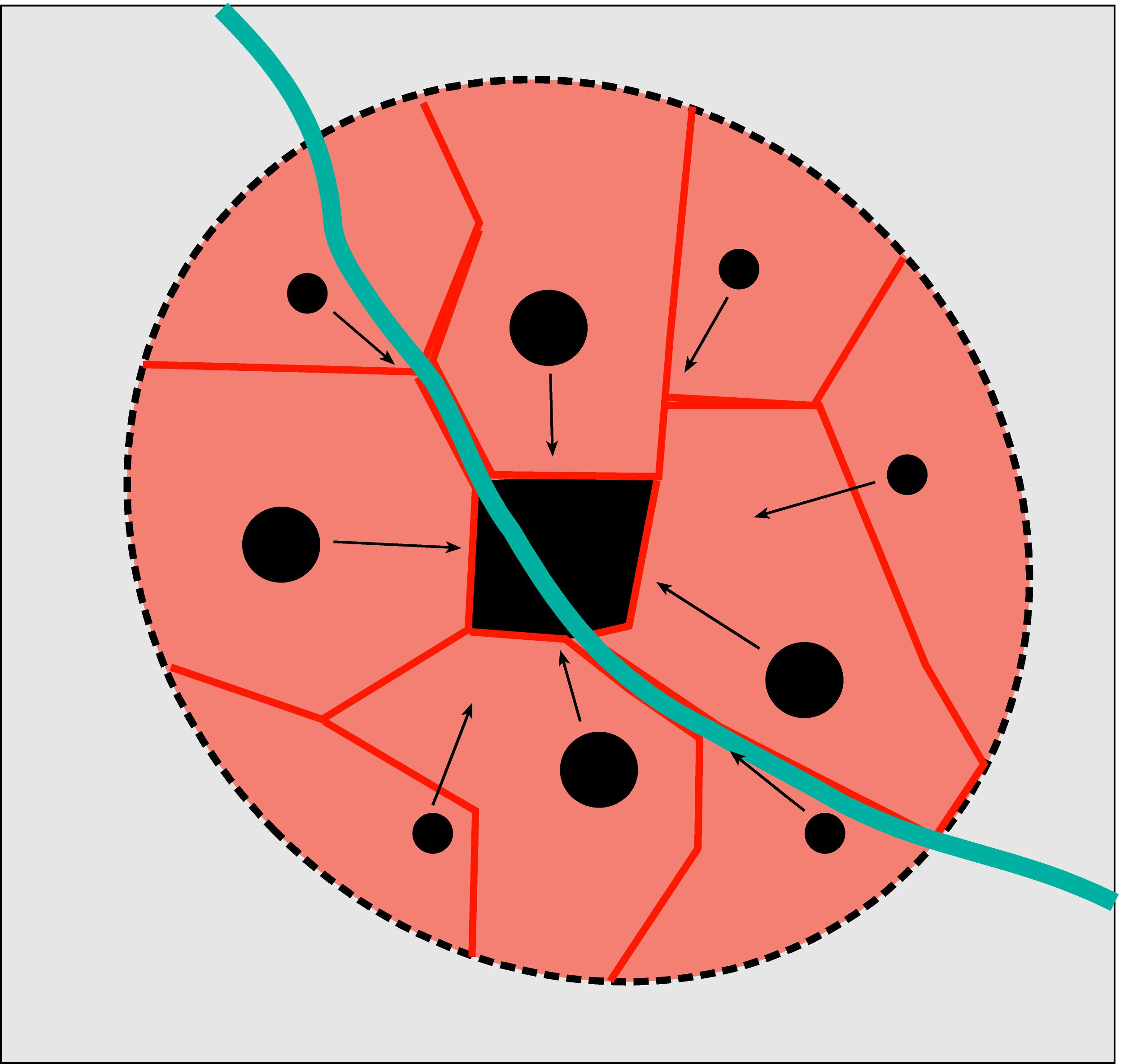 A graphic representation of the Sumerian city-state model (cf. "The core" ...)
### Figure 6a: Commercial routes {#6a TO="commercial routes"}
A graphic representation of the Sumerian city-state model (cf. "The core" ...)
### Figure 6a: Commercial routes {#6a TO="commercial routes"}
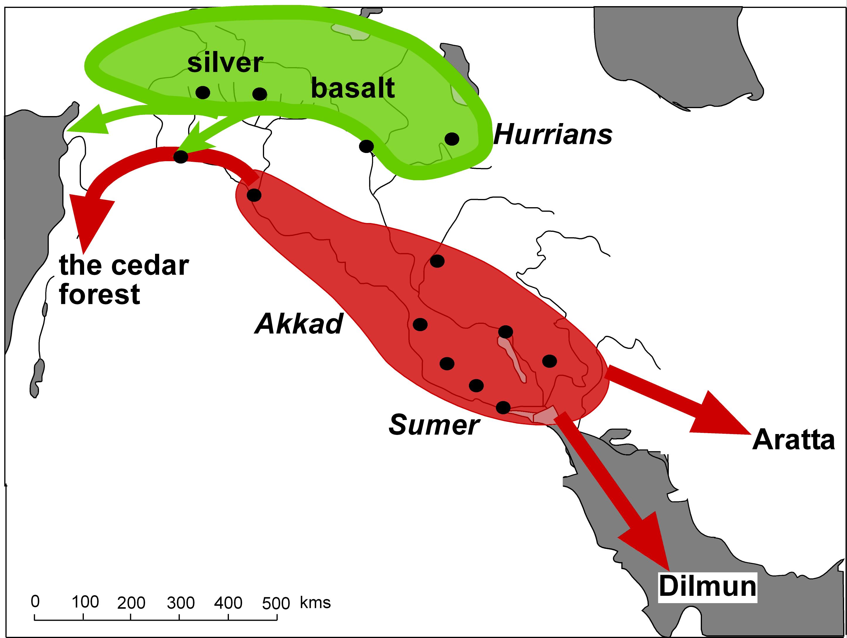 From Mesopotamia, commercial routes where established towards the South-East (the Persian Gulf) and to the Noth-West; some of these routes are also mentioned in expeditions attested in literary compositions, such as the "Epic of Gilgamesh" (cf. below, Fig. 6b).
### Figure 6b: "Epic" expeditions {#6b TO="epic expeditions"}
From Mesopotamia, commercial routes where established towards the South-East (the Persian Gulf) and to the Noth-West; some of these routes are also mentioned in expeditions attested in literary compositions, such as the "Epic of Gilgamesh" (cf. below, Fig. 6b).
### Figure 6b: "Epic" expeditions {#6b TO="epic expeditions"}
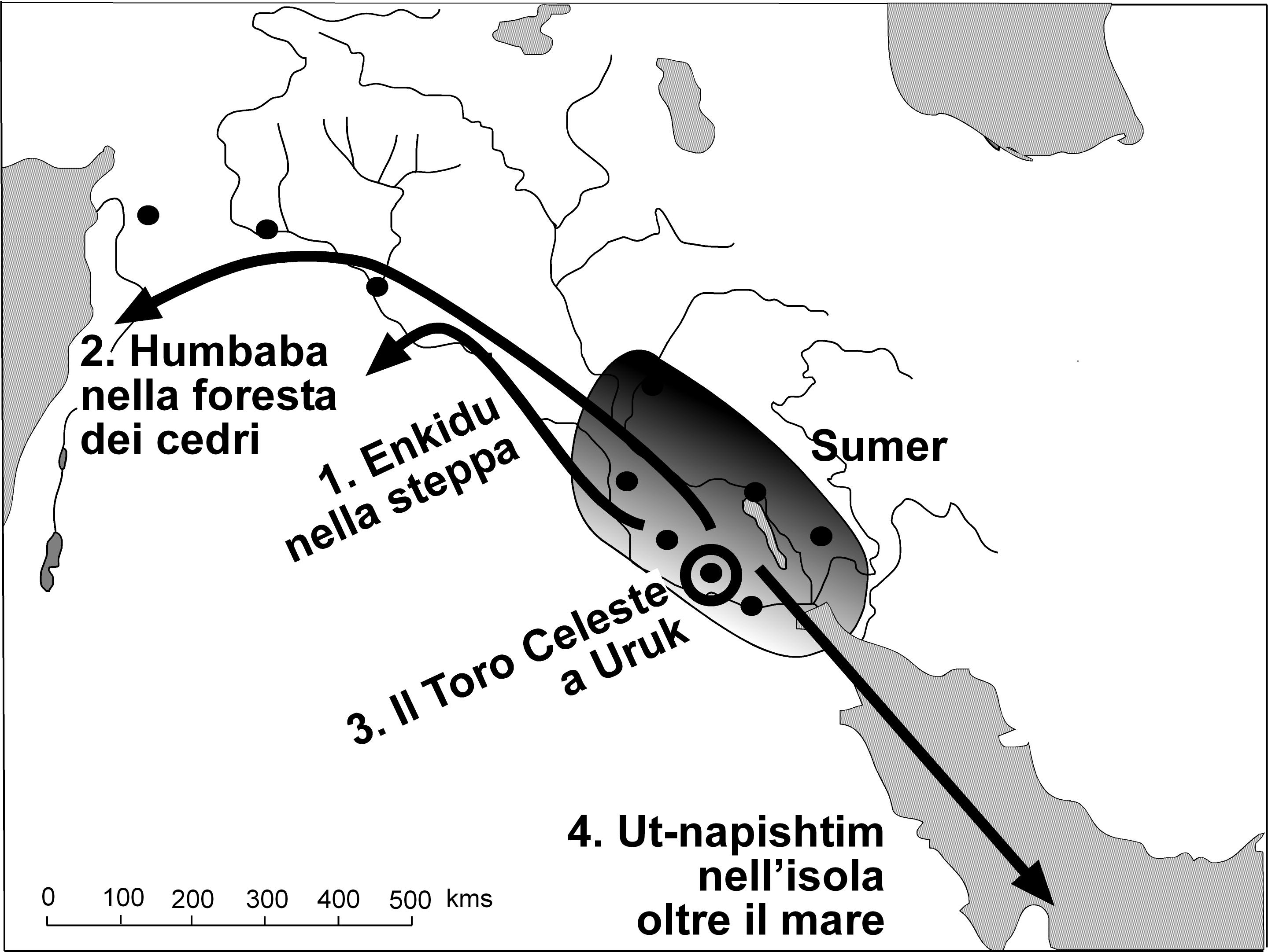 In the "Epic of Gilgamesh", some expeditions are told referring to actual or mythical locations situated all around the Mesopotamian world
### Figure 7a: Hurrian city-state model {#7a TO="Hurrian city-state model"}
In the "Epic of Gilgamesh", some expeditions are told referring to actual or mythical locations situated all around the Mesopotamian world
### Figure 7a: Hurrian city-state model {#7a TO="Hurrian city-state model"}
 A model of the Hurrian city-state structure
### Figure 7b: Hurrian city-state model: the outer boundary {#7b TO="Hurrian city-state model: the outher boundary"}
A model of the Hurrian city-state structure
### Figure 7b: Hurrian city-state model: the outer boundary {#7b TO="Hurrian city-state model: the outher boundary"}
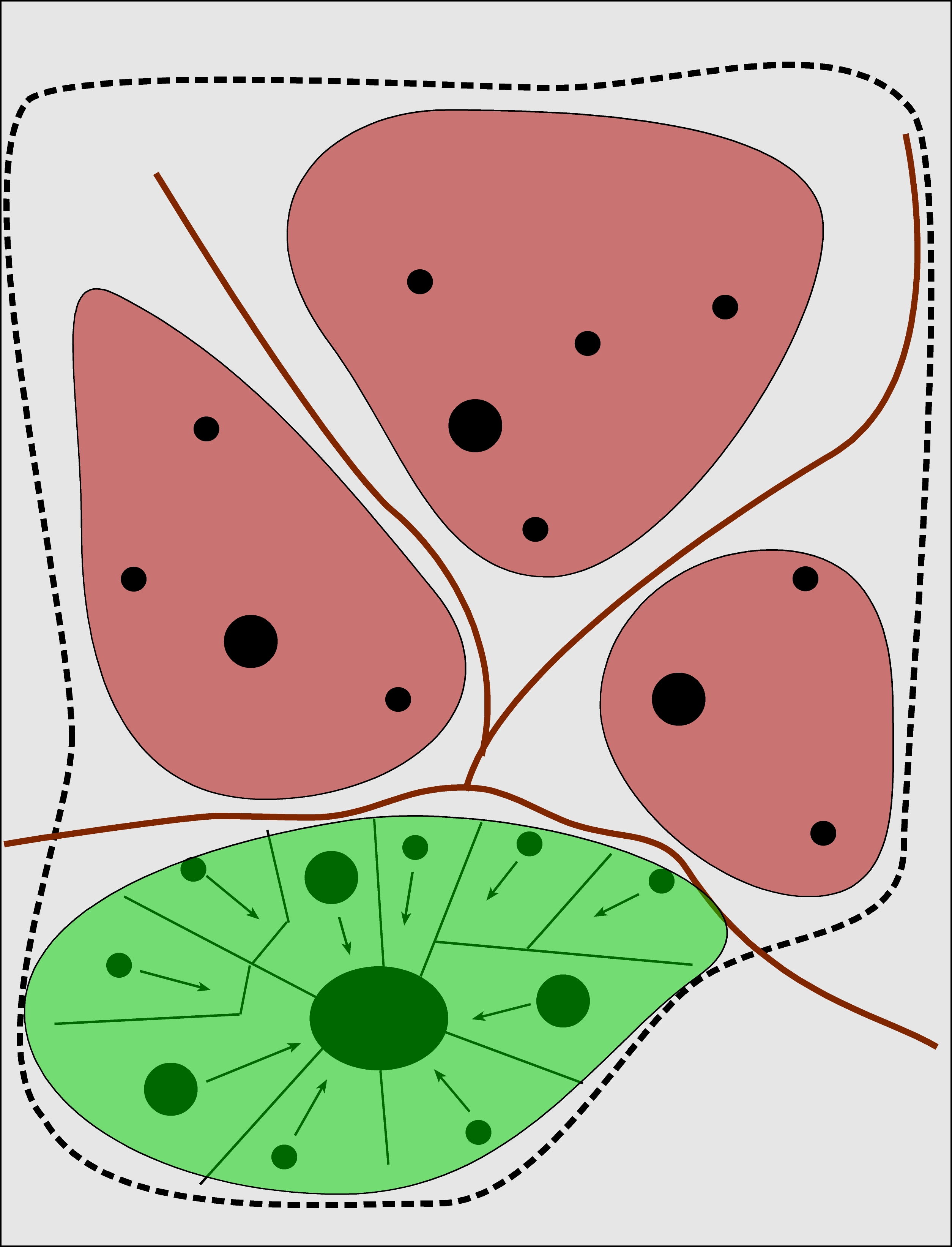 A wider, "expanded" model of the Hurrian city-state structure, including expansion towards areas outside of the main city; various citadel nuclei developed within the outer boundary of the core center
Back to top: Resources